Police Helicopter to MOD St Athan
Monday, 6 April 2026 | 13:42 | From MOD St Athan
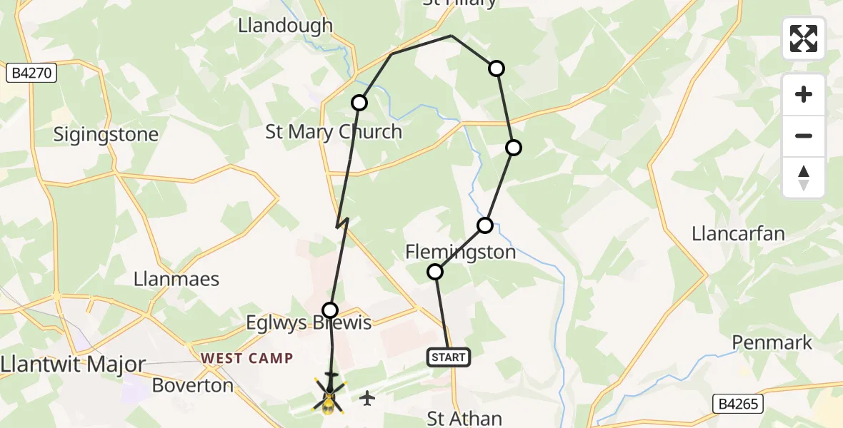
On Monday, 6 April 2026 at 13:42, a Police Helicopter departed from MOD St Athan to MOD St Athan. It was the Police Helicopter with registration number G-NWOI. The flight lasted 3 minutes. During that period, the aircraft travelled 6 miles at an average speed of 113 miles per hour at a maximum altitude of 900 feet.
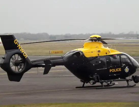
Helicopter: G-NWOI
The helicopter G-NWOI is used by the British police. The helicopter is deployed in pursuits, missing persons cases and other incidents where a helicopter provides added value.
Photo: James from Cheltenham
7 miles
900 feet
113 mph
4 minutes
13:42
13:46

Route
MOD St Athan, St Athan, Vale of Glamorgan13:46
MOD St Athan, St Athan, Vale of Glamorgan13:45
St Mary Church, Vale of Glamorgan13:44
St Hilary, Vale of Glamorgan13:43
Flemingston, Vale of Glamorgan13:43
Llanfair, Vale of Glamorgan13:43
Flemingston, Vale of Glamorgan13:43
MOD St Athan, St Athan, Vale of Glamorgan13:42
Live flights
Today
Police Helicopter to Deri20:50:27
Helicopter flights on your website?
You can easily display helicopter flights on your own website. Use the embed code.
