Air Ambulance Helicopter to South Molton, Station Road
Monday, 6 April 2026 | 11:45 | From Cranbrook
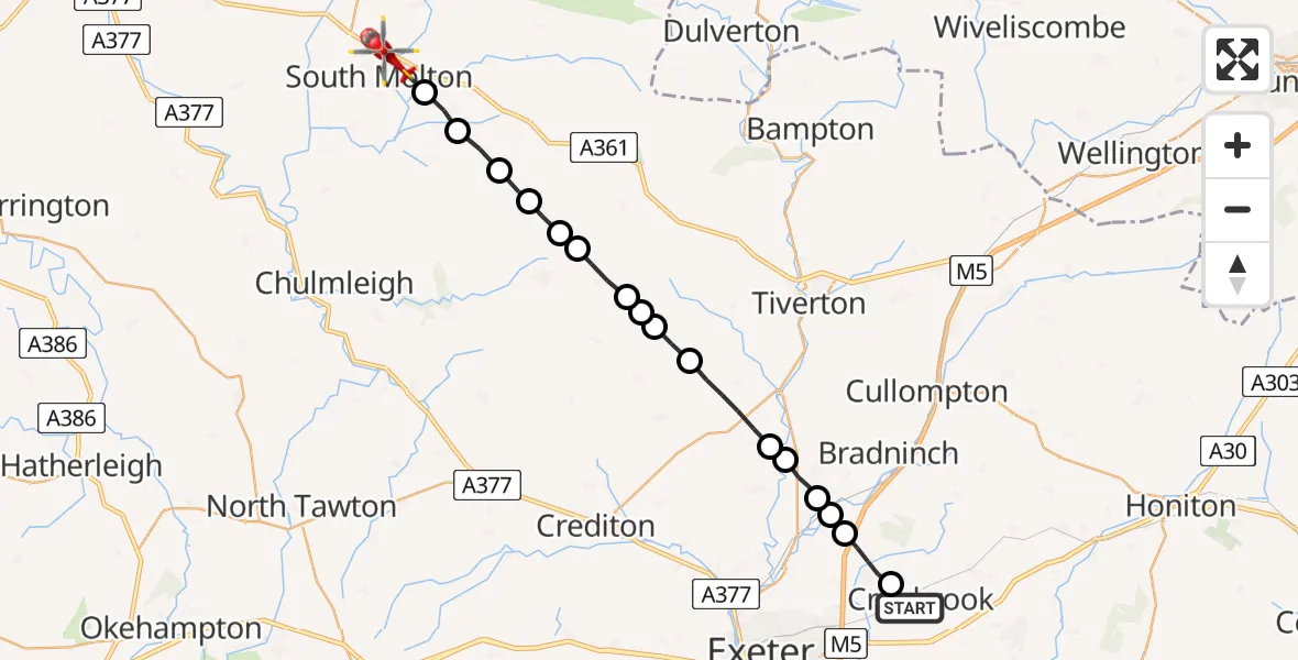
On Monday, 6 April 2026 at 11:45, a Air Ambulance Helicopter departed from Cranbrook to South Molton. It was the Air Ambulance Helicopter with registration number G-DAAN. The flight lasted 10 minutes. During that period, the aircraft travelled 27 miles at an average speed of 158 miles per hour at a maximum altitude of 1325 feet.
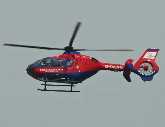
Helicopter: G-DAAN
The helicopter G-DAAN is used as a air ambulance helicopter. The main purpose of this aircraft is to transport a Mobile Medical Team to an incident as quickly as possible, enabling the trauma doctor to provide immediate first aid on site. The aircraft is flying this flight as Air Ambulance Helicopter.
Photo: Alan Wilson
27 miles
1325 feet
158 mph
11 minutes
11:45
11:55

Route
Station Road, Devon11:55
North Devon, Devon11:54
Bishops Nympton, Devon11:54
Rose Ash, Devon11:53
Witheridge, Devon11:52
North Devon, Devon11:52
Witheridge, Devon11:51
Mid Devon, Devon11:50
Puddington, Devon11:50
Pennymoor, Devon11:50
Way Village, Devon11:49
Mid Devon, Devon11:48
East Devon, Devon11:47
Silverton, Devon11:47
Rewe, Devon11:46
East Devon, Devon11:46
Broadclyst, Devon11:45
B3174, Devon11:45
Live flights
Today
Flights Cranbrook
Police Helicopter to Aylesbeare, Silver Lane9 Jul 19:46
Police Helicopter to Rockbeare, Yarlington Mill27 Jun 21:56
Air Ambulance Helicopter to Dunster20 May 17:16
Police Helicopter to Rockbeare, Westcott Road17 May 22:03
Air Ambulance Helicopter to Halberton2 May 12:59
Helicopter flights on your website?
You can easily display helicopter flights on your own website. Use the embed code.
