Air Ambulance Helicopter to Cranborne, Penny's Mead
Monday, 6 April 2026 | 1:07 | From Henstridge Airfield
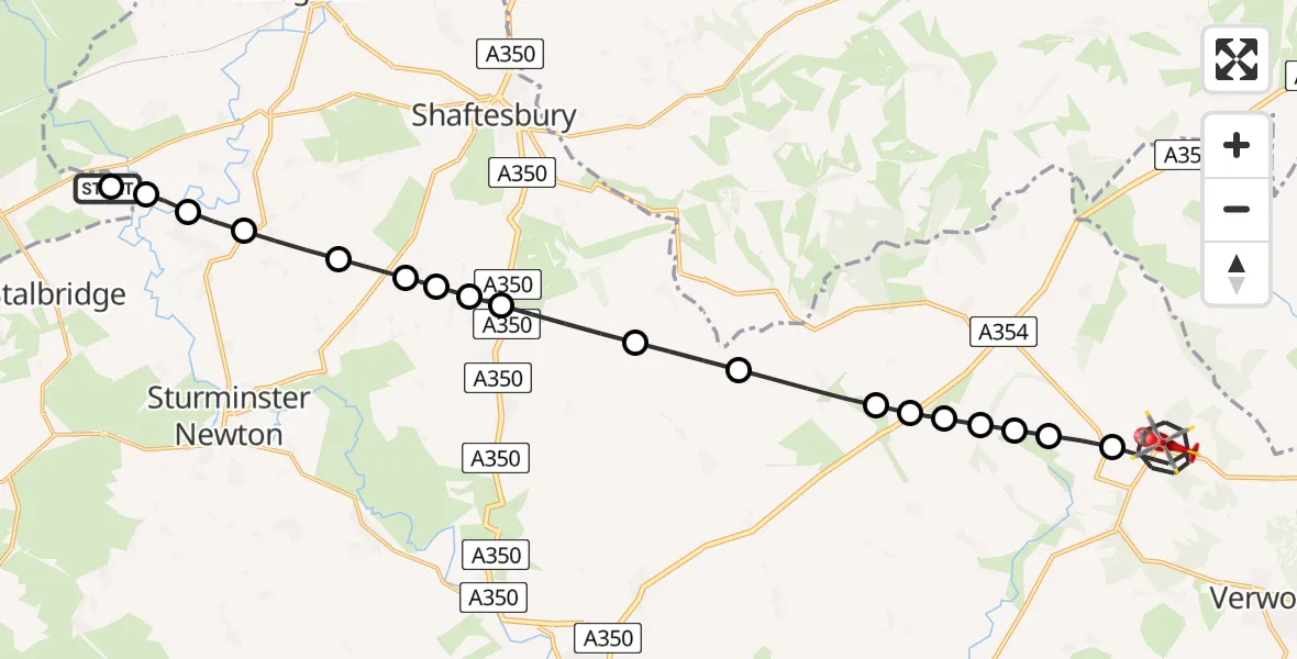
On Monday, 6 April 2026 at 1:07, a Air Ambulance Helicopter departed from Henstridge Airfield to Cranborne. It was the Air Ambulance Helicopter with registration number G-DSAA. The flight lasted 12 minutes. During that period, the aircraft travelled 23 miles at an average speed of 113 miles per hour at a maximum altitude of 1000 feet.
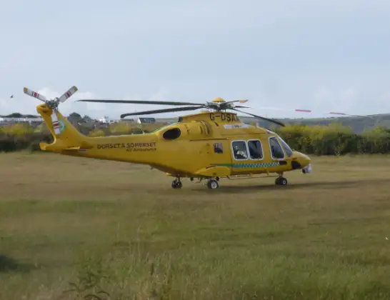
Helicopter: G-DSAA
The helicopter G-DSAA is used as a air ambulance helicopter. The main purpose of this aircraft is to transport a Mobile Medical Team to an incident as quickly as possible, enabling the trauma doctor to provide immediate first aid on site. The aircraft is flying this flight as Air Ambulance Helicopter.
Photo: Andrew Bone
24 miles
1000 feet
113 mph
13 minutes
01:07
01:19

Route
Cranborne, Dorset01:19
Penny's Mead, Dorset01:19
Cranborne, Dorset01:15
Wimborne St Giles, Dorset01:15
Gussage St. Michael, Dorset01:15
Gussage All Saints, Dorset01:14
Gussage St. Michael, Dorset01:14
Gussage St Andrew, Dorset01:14
Gussage St. Michael, Dorset01:14
Farnham, Dorset01:13
Ashmore, Dorset01:12
Fontmell Magna, Dorset01:11
Compton Abbas, Dorset01:11
Fontmell Magna, Dorset01:10
Margaret Marsh, Dorset01:10
Fontmell Magna, Dorset01:10
Todber, Dorset01:09
Marnhull, Dorset01:08
Fifehead Hill, Dorset01:08
Fifehead Magdalen, Dorset01:08
Henstridge, Somerset01:07
Henstridge Airfield, Templecombe, Somerset01:07
Today
Flights Cranborne
Helicopter flights on your website?
You can easily display helicopter flights on your own website. Use the embed code.
