Air Ambulance Helicopter to Tong, Tong Park Drive
Sunday, 5 April 2026 | 18:22 | From Norton Canes
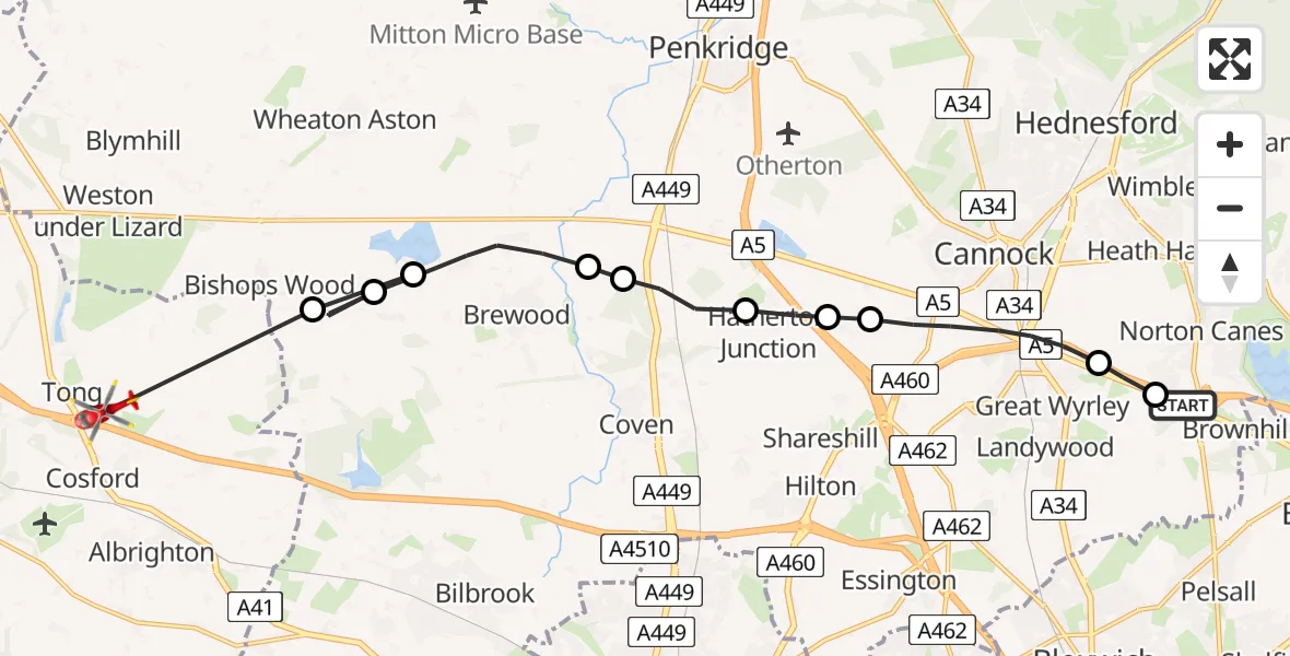
On Sunday, 5 April 2026 at 18:22, a Air Ambulance Helicopter departed from Norton Canes to Tong. It was the Air Ambulance Helicopter with registration number G-SCAA. The flight lasted 7 minutes. During that period, the aircraft travelled 16 miles at an average speed of 136 miles per hour at a maximum altitude of 1250 feet.
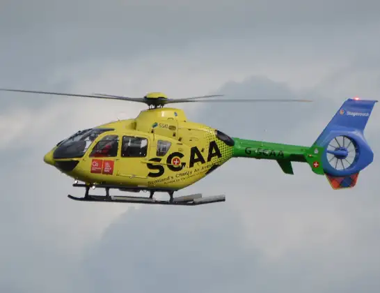
Helicopter: G-SCAA
The helicopter G-SCAA is used as a air ambulance helicopter. The main purpose of this aircraft is to transport a Mobile Medical Team to an incident as quickly as possible, enabling the trauma doctor to provide immediate first aid on site. The aircraft is flying this flight as Air Ambulance Helicopter.
Photo: Jonathan Payne
17 miles
1250 feet
136 mph
8 minutes
18:22
18:29

Route
Tong Park Drive, West Midlands - Shropshire18:29
Bishops Wood, Staffordshire18:28
Brewood, Staffordshire18:28
Bishops Wood, Staffordshire18:28
Brewood, Staffordshire18:26
South Staffordshire, Staffordshire18:26
Penkridge, Staffordshire18:25
Hatherton Junction, Staffordshire18:25
South Staffordshire, Staffordshire18:25
Cannock, Staffordshire18:23
Norton Canes, Staffordshire18:23
Watling Street, West Midlands - Staffordshire18:22
Live flights
Police Helicopter on its way from Irlam5 Apr 22:59
Police Helicopter on its way from Salfords5 Apr 22:53
Today
Police Helicopter to North Weald Airfield5 Apr 22:29
Air Ambulance Helicopter to Cardiff Heliport5 Apr 22:23
Air Ambulance Helicopter to Glasgow Airport5 Apr 22:12
Coastguard Helicopter to Solent Airport5 Apr 21:37
Coastguard Helicopter to Inverness Airport5 Apr 21:29
Flights Tong
Air Ambulance Helicopter to Tong, M5431 Mar 16:14
Air Ambulance Helicopter to Tong, Airbase Avenue24 Mar 12:41
Air Ambulance Helicopter to Tong, M5421 Mar 14:09
Air Ambulance Helicopter to Tong, B439619 Mar 13:11
Air Ambulance Helicopter to Tong19 Mar 13:02
Air Ambulance Helicopter to Tong, Tong Lane14 Jan 13:10
Helicopter flights on your website?
You can easily display helicopter flights on your own website. Use the embed code.
