Police Helicopter to East Lulworth, Mount Pleasant
Sunday, 5 April 2026 | 17:29 | From Parley Cross
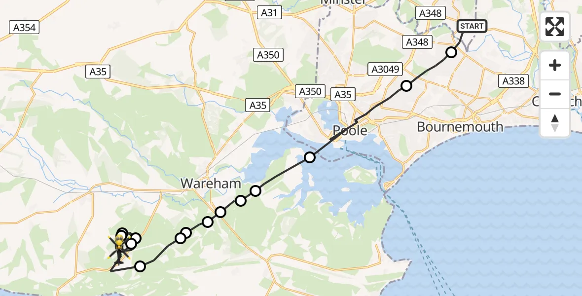
On Sunday, 5 April 2026 at 17:29, a Police Helicopter departed from Parley Cross to East Lulworth. It was the Police Helicopter with registration number G-CPAO. The flight lasted 13 minutes. During that period, the aircraft travelled 25 miles at an average speed of 113 miles per hour at a maximum altitude of 1275 feet.
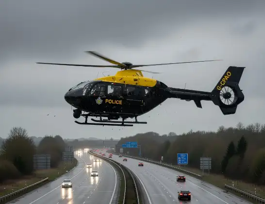
Helicopter: G-CPAO
The helicopter G-CPAO is used by the British police. The helicopter is deployed in pursuits, missing persons cases and other incidents where a helicopter provides added value.
Photo: Tony Melony
26 miles
1275 feet
113 mph
14 minutes
17:29
17:42

Route
Mount Pleasant, Dorset17:42
East Lulworth, Dorset17:41
Coombe Keynes, Dorset17:40
East Lulworth, Dorset17:39
Coombe Keynes, Dorset17:38
East Lulworth, Dorset17:37
Steeple with Tyneham, Dorset17:36
East Holme, Dorset17:36
Stoborough, Dorset17:35
Stoborough Green, Dorset17:35
Ridge, Dorset17:35
Wareham, Dorset17:34
Arne, Dorset17:33
Poole, Bournemouth, Christchurch and Poole17:31
Bournemouth, Bournemouth, Christchurch and Poole17:30
Christchurch Road, Dorset17:29
Live flights
Helicopter flights on your website?
You can easily display helicopter flights on your own website. Use the embed code.
