Air Ambulance Helicopter to Comins-coch / Commins Coch, A470
Sunday, 5 April 2026 | 11:28 | From Welshpool Airport
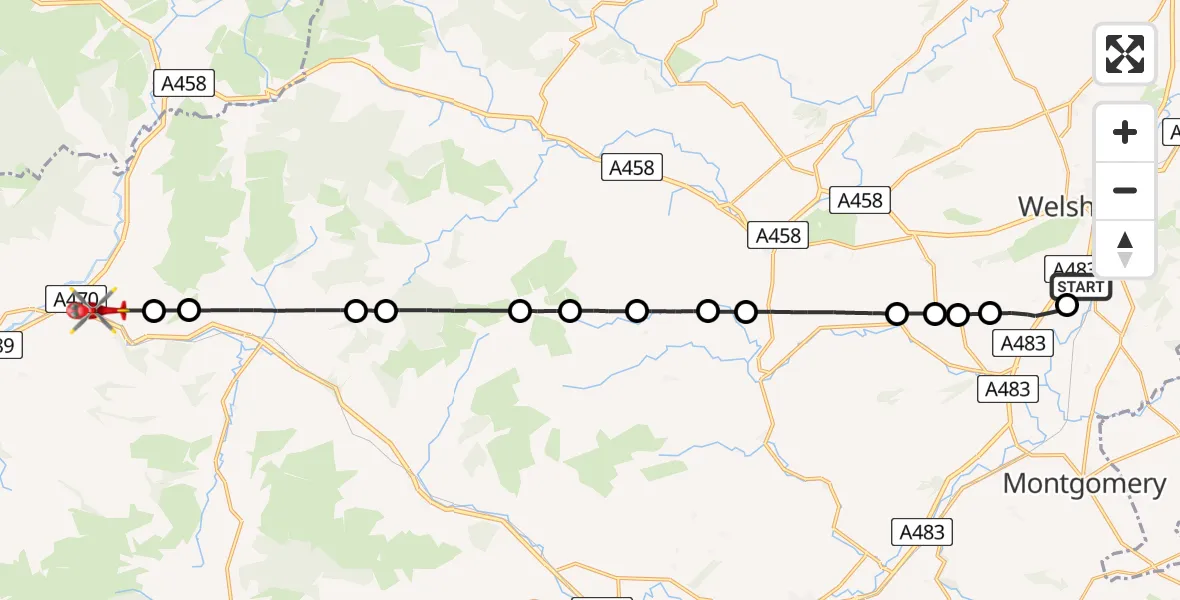
On Sunday, 5 April 2026 at 11:28, a Air Ambulance Helicopter departed from Welshpool Airport to Comins-coch / Commins Coch. It was the Air Ambulance Helicopter with registration number G-WENU. The flight lasted 13 minutes. During that period, the aircraft travelled 24 miles at an average speed of 112 miles per hour at a maximum altitude of 1775 feet.
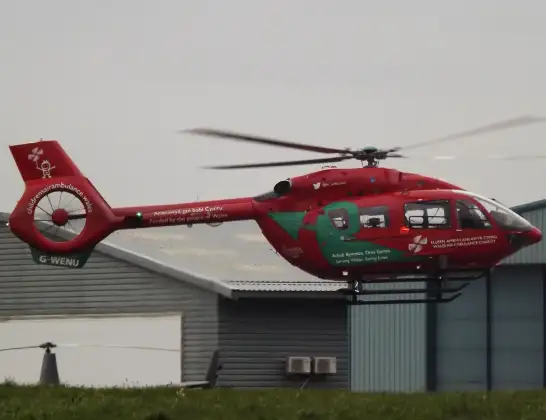
Helicopter: G-WENU
The helicopter G-WENU is used as a air ambulance helicopter. The main purpose of this aircraft is to transport a Mobile Medical Team to an incident as quickly as possible, enabling the trauma doctor to provide immediate first aid on site. The aircraft is flying this flight as Air Ambulance Helicopter.
Photo: James from Cheltenham, Gloucestershire
25 miles
1775 feet
112 mph
14 minutes
11:28
11:42

Route
A470, Powys11:42
Comins-coch / Commins Coch, Powys11:41
Glantwymyn, Powys11:40
Llanbrynmair, Powys11:38
Talerddig, Powys11:38
Llanerfyl, Powys11:36
Dwyriw, Powys11:36
Llanfair Caereinion, Powys11:35
Llanllugan, Powys11:34
Llanfair Caereinion, Powys11:33
Manafon, Powys11:32
Berriew, Powys11:31
Castle Caereinion, Powys11:31
Berriew, Powys11:30
Trehelig, Powys11:29
Welshpool Airport, Welshpool, Powys11:28
Live flights
Helicopter flights on your website?
You can easily display helicopter flights on your own website. Use the embed code.
