Air Ambulance Helicopter to Pontesbury, Minsterley Road
Sunday, 5 April 2026 | 10:13 | From RAF Cosford
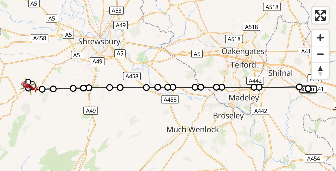
On Sunday, 5 April 2026 at 10:13, a Air Ambulance Helicopter departed from RAF Cosford to Pontesbury. It was the Air Ambulance Helicopter with registration number G-RMAA. The flight lasted 17 minutes. During that period, the aircraft travelled 27 miles at an average speed of 96 miles per hour at a maximum altitude of 1175 feet.
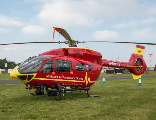
Helicopter: G-RMAA
The helicopter G-RMAA is used as a air ambulance helicopter. The main purpose of this aircraft is to transport a Mobile Medical Team to an incident as quickly as possible, enabling the trauma doctor to provide immediate first aid on site. The aircraft is flying this flight as Air Ambulance Helicopter.
Photo: Steve Lynes
27 miles
1175 feet
96 mph
17 minutes
10:13
10:30

Route
Minsterley Road, West Midlands - Shropshire10:30
Pontesbury, Shropshire10:28
Minsterley, Shropshire10:28
Pontesbury, Shropshire10:27
Plealey, Shropshire10:27
Longden, Shropshire10:26
Condover, Shropshire10:25
Stapleton, Shropshire10:25
Condover, Shropshire10:24
Berrington, Shropshire10:23
Cross Houses, Shropshire10:22
Eyton on Severn, Shropshire10:22
Leighton, Shropshire10:21
Leighton and Eaton Constantine, Shropshire10:21
Leighton, Shropshire10:20
Buildwas, Shropshire10:20
Little Wenlock, Telford and Wrekin10:19
Coalbrookdale, Telford and Wrekin10:19
Dawley, Telford and Wrekin10:17
Shifnal, Telford and Wrekin10:17
Holyhead Road, West Midlands - Shropshire10:15
Cosford, Shropshire10:13
RAF Cosford, Cosford10:13
Live flights
Today
Police Helicopter to Bournemouth Airport5 Apr 23:23
Air Ambulance Helicopter to Argyll and Bute5 Apr 23:21
Police Helicopter to Hawarden Airport5 Apr 22:59
Police Helicopter to Redhill Aerodrome5 Apr 22:53
Air Ambulance Helicopter to Logierait, C4525 Apr 22:50
Police Helicopter to North Weald Airfield5 Apr 22:29
Air Ambulance Helicopter to Cardiff Heliport5 Apr 22:23
Flights Pontesbury
Helicopter flights on your website?
You can easily display helicopter flights on your own website. Use the embed code.
