Air Ambulance Helicopter to Argyll and Bute, B839
Friday, 3 April 2026 | 9:06 | From Glasgow Airport
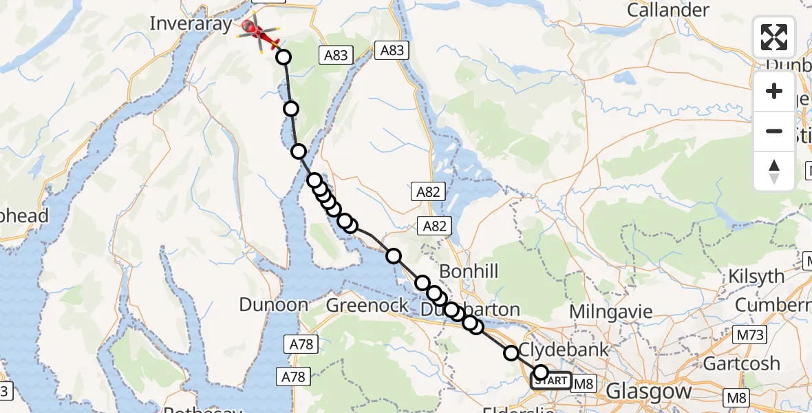
On Friday, 3 April 2026 at 9:06, a Air Ambulance Helicopter departed from Glasgow Airport to Argyll and Bute. It was the Air Ambulance Helicopter with registration number G-ISAS. The flight lasted 15 minutes. During that period, the aircraft travelled 33 miles at an average speed of 129 miles per hour at a maximum altitude of 2650 feet.
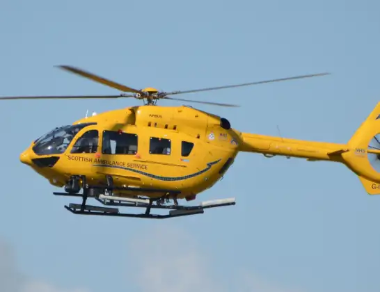
Helicopter: G-ISAS
The helicopter G-ISAS is used as a air ambulance helicopter. The main purpose of this aircraft is to transport a Mobile Medical Team to an incident as quickly as possible, enabling the trauma doctor to provide immediate first aid on site. The aircraft is flying this flight as Air Ambulance Helicopter.
Photo: Jonathan Payne
33 miles
2650 feet
129 mph
16 minutes
09:06
09:21

Route
B839, Argyll and Bute09:21
Argyll and Bute, Argyll and Bute09:20
Lochgoilhead, Argyll and Bute09:18
Carrick Castle, Argyll and Bute09:17
Inner Seas09:16
Garelochhead, Argyll and Bute09:16
Creag Liomha, Argyll and Bute09:16
Rahane, Argyll and Bute09:15
Glengair, Argyll and Bute09:15
Shandon, Argyll and Bute09:15
Rhu, Argyll and Bute09:14
Helensburgh, Argyll and Bute09:13
Colgrain, Argyll and Bute09:11
Cardross, Argyll and Bute09:11
Ardoch, Argyll and Bute09:11
Inner Seas09:10
Dumbarton, West Dunbartonshire09:10
Langbank, Renfrewshire09:09
Renfrewshire, Renfrewshire09:09
Bishopton, Renfrewshire09:08
Erskine, Renfrewshire09:06
Glasgow Airport, Glasgow09:06
Live flights
Today
Helicopter flights on your website?
You can easily display helicopter flights on your own website. Use the embed code.
