Coastguard Helicopter to Flamborough, Lighthouse Road
Thursday, 2 April 2026 | 15:15 | From Flamborough
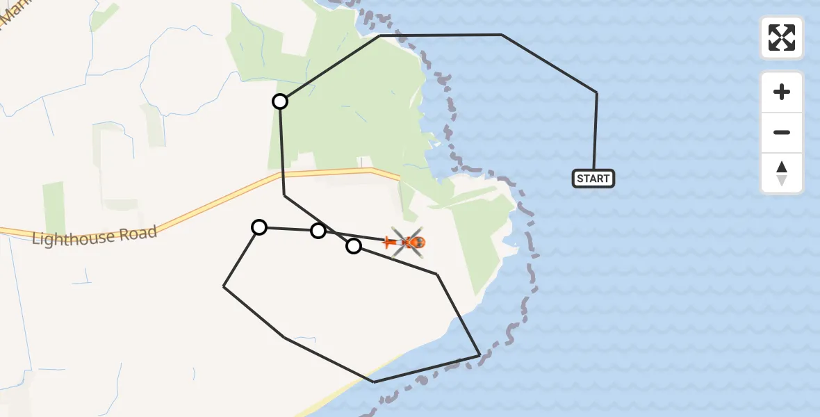
On Thursday, 2 April 2026 at 15:15, a Coastguard Helicopter departed from Flamborough to Flamborough. It was the Coastguard Helicopter with registration number G-MCGE. The flight lasted 4 minutes. During that period, the aircraft travelled 4 miles at an average speed of 56 miles per hour at a maximum altitude of 400 feet.
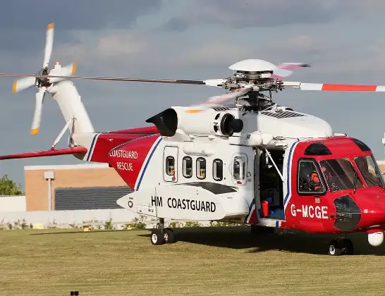
Helicopter: G-MCGE
The helicopter G-MCGE is used by the British Coastguard. The helicopter is deployed in search and rescue operations at sea, rescue operations involving ships or drilling platforms, patrols to prevent smuggling or piracy, environmental monitoring and disaster relief support.
Photo: Mike Burdett
4 miles
400 feet
56 mph
5 minutes
15:15
15:19

Route
Lighthouse Road, East Riding of Yorkshire15:19
Flamborough, East Riding of Yorkshire15:18
Bridlington, East Riding of Yorkshire15:18
Flamborough, East Riding of Yorkshire15:16
Bridlington, East Riding of Yorkshire15:16
Flamborough, East Riding of Yorkshire15:15
Today
Flights Flamborough
Coastguard Helicopter to Humberside Airport4 Jul 15:43
Coastguard Helicopter to Humberside Airport3 Jul 18:11
Coastguard Helicopter to North Sea18 Jun 10:21
Coastguard Helicopter to Flamborough18 Jun 09:49
Air Ambulance Helicopter to RAF Topcliffe16 Jun 12:27
Helicopter flights on your website?
You can easily display helicopter flights on your own website. Use the embed code.
