Air Ambulance Aircraft to Dyce and Stoneywood, Pitmedden Road
Thursday, 2 April 2026 | 13:05 | From Warthill Road
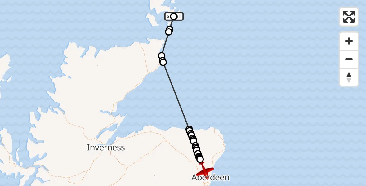
On Thursday, 2 April 2026 at 13:05, a Air Ambulance Aircraft departed from Warthill Road to Dyce and Stoneywood. It was the Air Ambulance Aircraft with registration number G-SASC. The flight lasted 29 minutes. During that period, the aircraft travelled 123 miles at an average speed of 259 miles per hour at a maximum altitude of 13000 feet.
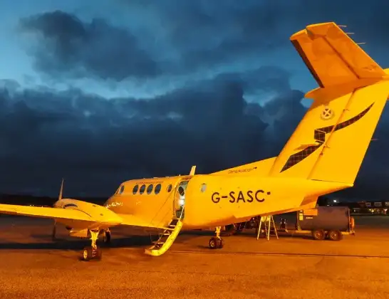
Helicopter: G-SASC
The aircraft G-SASC is used as an air ambulance aircraft. The main purpose of this aircraft is to transport a Mobile Medical Team to an incident as quickly as possible, enabling the trauma doctor to provide immediate first aid on site. The aircraft is flying this flight as Air Ambulance Aircraft.
Photo: Mike Pennington
124 miles
13000 feet
259 mph
29 minutes
13:05
13:34

Route
Pitmedden Road, Aberdeen City13:34
Oldmeldrum, Aberdeenshire13:30
St Katherines, Aberdeenshire13:30
Aberdeenshire, Aberdeenshire13:30
Tulloch, Aberdeenshire13:29
Barthol Chapel, Aberdeenshire13:29
Fyvie, Aberdeenshire13:28
Tifty, Aberdeenshire13:28
Gourdas, Aberdeenshire13:27
Birkenhills, Aberdeenshire13:27
Turriff, Aberdeenshire13:26
Fintry, Aberdeenshire13:26
Aberdeenshire, Aberdeenshire13:26
King Edward, Aberdeenshire13:25
Mill of Eden, Aberdeenshire13:25
Banff, Aberdeenshire13:25
Inverboyndie, Aberdeenshire13:24
North Sea13:14
Papigoe, Highland13:14
Wick, Highland13:13
North Sea13:08
South Ronaldsay, Orkney Islands13:08
North Atlantic Ocean13:05
Warthill Road, Orkney Islands13:05
Live flights
Today
Police Aircraft to East Midlands Airport7 Jul 22:05
Helicopter flights on your website?
You can easily display helicopter flights on your own website. Use the embed code.
