Coastguard Drone to English Channel
Thursday, 2 April 2026 | 4:32 | From English Channel
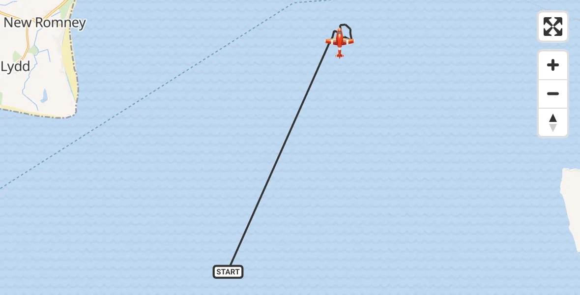
On Thursday, 2 April 2026 at 4:32, a Coastguard Drone departed from English Channel to English Channel. It was the Coastguard Drone with registration number G-UASA. The flight lasted 4 minutes. During that period, the aircraft travelled 17 miles at an average speed of 256 miles per hour at a maximum altitude of 1300 feet.
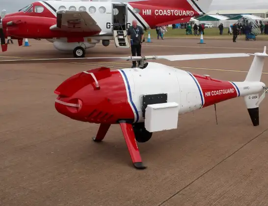
Helicopter: G-UASA
The drone G-UASA is used by the British Coastguard. The drone is deployed in search and rescue operations at sea, rescue operations involving ships or drilling platforms, patrols to prevent smuggling or piracy, environmental monitoring and disaster relief support.
Photo: Mike Burdett, CROMER, UK
18 miles
1300 feet
256 mph
5 minutes
04:32
04:36

Route
English Channel, 04:36
English Channel, 04:32
Live flights
Today
Air Ambulance Helicopter to Redhill Aerodrome14 Jul 23:46
Coastguard Helicopter to Humberside Airport14 Jul 23:44
Police Helicopter to Johnstone, Gordon Square14 Jul 23:38
Coastguard Helicopter to North Sea14 Jul 23:30
Police Helicopter to Inner Seas14 Jul 23:12
Air Ambulance Helicopter to Norwich Airport14 Jul 22:52
Helicopter flights on your website?
You can easily display helicopter flights on your own website. Use the embed code.
