Air Ambulance Helicopter to East Peckham, Maidstone Road
Wednesday, 1 April 2026 | 19:17 | From Redhill Aerodrome
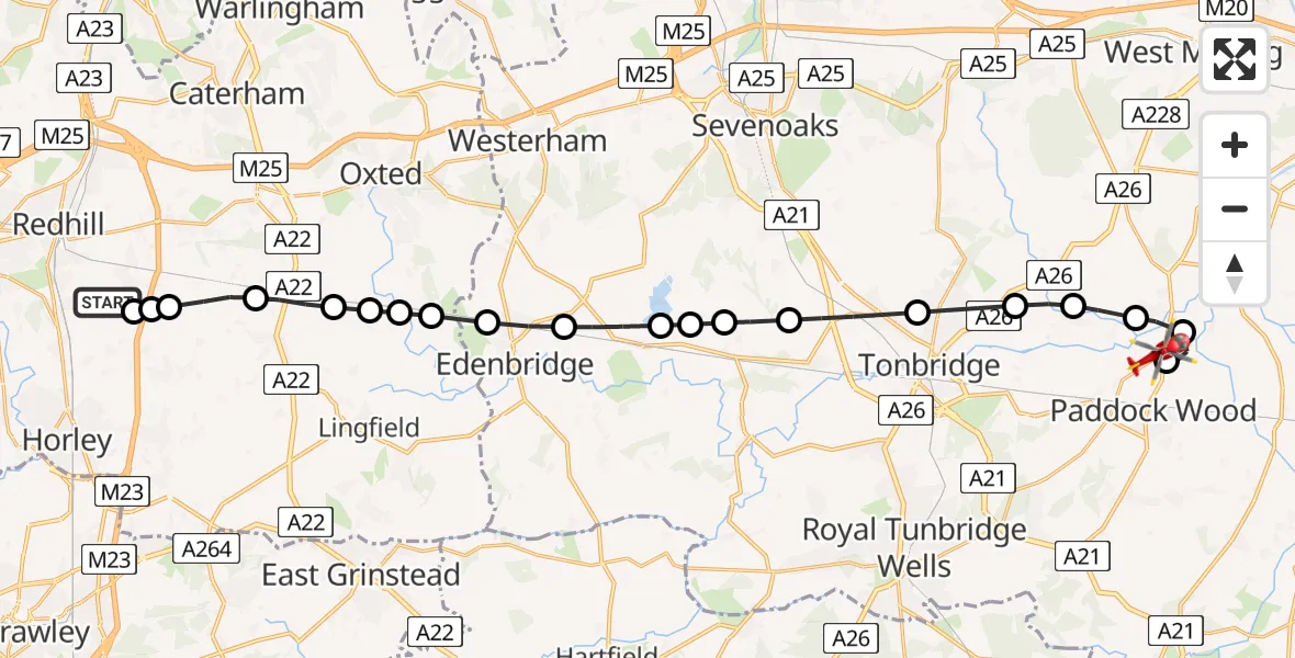
On Wednesday, 1 April 2026 at 19:17, a Air Ambulance Helicopter departed from Redhill Aerodrome to East Peckham. It was the Air Ambulance Helicopter with registration number G-LNAC. The flight lasted 11 minutes. During that period, the aircraft travelled 25 miles at an average speed of 136 miles per hour at a maximum altitude of 1050 feet.
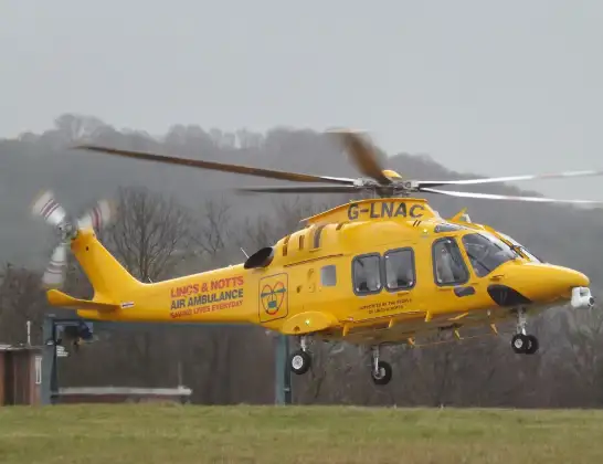
Helicopter: G-LNAC
The helicopter G-LNAC is used as a air ambulance helicopter. The main purpose of this aircraft is to transport a Mobile Medical Team to an incident as quickly as possible, enabling the trauma doctor to provide immediate first aid on site. The aircraft is flying this flight as Air Ambulance Helicopter.
Photo: James from Cheltenham, Gloucestershire
26 miles
1050 feet
136 mph
12 minutes
19:17
19:28

Route
Maidstone Road, Kent19:28
East Peckham, Kent19:27
Yalding, Kent19:26
East Peckham, Kent19:26
Golden Green, Kent19:25
Hadlow, Kent19:25
Tonbridge, Kent19:24
Hildenborough, Kent19:23
Chiddingstone Causeway, Kent19:22
Sevenoaks, Kent19:22
Bough Beech Reservoir19:22
Hever, Kent19:21
Edenbridge, Kent19:21
Tandridge, Surrey19:20
Homefield Farm / Edenbridge Airstrip19:20
Merle Common, Surrey19:20
Crowhurst, Surrey19:19
South Godstone, Surrey19:19
Tandridge, Surrey19:18
South Nutfield, Surrey19:18
Moats Lane, Surrey19:17
Redhill Aerodrome, Redhill, Surrey19:17
Live flights
Today
Police Helicopter to Glasgow, South Street6 Jul 23:22
Police Helicopter to South Lanarkshire6 Jul 23:09
Police Helicopter to North Weald Airfield6 Jul 22:57
Police Aircraft to East Midlands Airport6 Jul 22:56
Police Helicopter to Lochhead, A726 Jul 22:39
Helicopter flights on your website?
You can easily display helicopter flights on your own website. Use the embed code.
