Police Helicopter to St. Columb Major
Wednesday, 1 April 2026 | 13:30 | From St Ive Keason
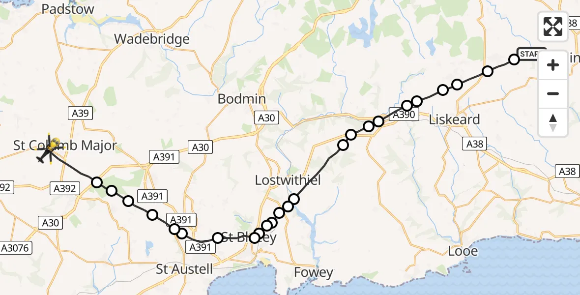
On Wednesday, 1 April 2026 at 13:30, a Police Helicopter departed from St Ive Keason to St. Columb Major. It was the Police Helicopter with registration number G-CPAS. The flight lasted 14 minutes. During that period, the aircraft travelled 31 miles at an average speed of 129 miles per hour at a maximum altitude of 2625 feet.
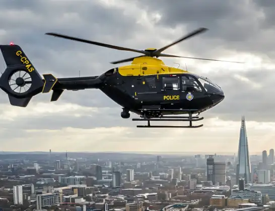
Helicopter: G-CPAS
The helicopter G-CPAS is used by the British police. The helicopter is deployed in pursuits, missing persons cases and other incidents where a helicopter provides added value.
Photo: Tony Melony
31 miles
2625 feet
129 mph
15 minutes
13:30
13:45

Route
St. Columb Major, Cornwall13:45
St. Columb Major, Cornwall13:43
Goss Moor Trail, Cornwall13:43
St Dennis, Cornwall13:42
St. Stephen-in-Brannel, Cornwall13:42
Stenalees, Cornwall13:41
Penwithick, Cornwall13:41
Trethurgy, Cornwall13:40
St Blazey, Cornwall13:39
Tywardreath, Cornwall13:39
St Blazey, Cornwall13:38
Tywardreath, Cornwall13:38
St Blazey, Cornwall13:38
Cornwall, Cornwall13:38
Lostwithiel, Cornwall13:38
Cornwall, Cornwall13:36
A390, Cornwall13:35
East Taphouse, Cornwall13:35
St. Neot, Cornwall13:35
Doublebois, Cornwall13:34
Dobwalls, Cornwall13:34
Liskeard, Cornwall13:33
St Cleer, Cornwall13:32
Pensilva, Cornwall13:32
Middlehill, Cornwall13:31
St Ive Keason, Cornwall13:30
Live flights
Air Ambulance Helicopter on its way from Ashford14 Jul 23:46
Coastguard Helicopter on its way from North Sea14 Jul 23:44
Today
Police Helicopter to Johnstone, Gordon Square14 Jul 23:38
Coastguard Helicopter to North Sea14 Jul 23:30
Police Helicopter to Inner Seas14 Jul 23:12
Air Ambulance Helicopter to Norwich Airport14 Jul 22:52
Police Helicopter to Manchester Barton Aerodrome14 Jul 22:50
Police Helicopter to Sewardstonebury, Bury Road14 Jul 22:44
Air Ambulance Helicopter to Cardiff Heliport14 Jul 22:43
Helicopter flights on your website?
You can easily display helicopter flights on your own website. Use the embed code.
