Police Helicopter to Neilston, Greenfieldmuir Road
Tuesday, 31 March 2026 | 18:15 | From Glenfield Grange
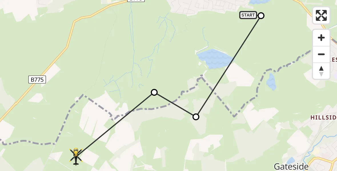
On Tuesday, 31 March 2026 at 18:15, a Police Helicopter departed from Glenfield Grange to Neilston. It was the Police Helicopter with registration number G-POLS. The flight lasted 1 minutes. During that period, the aircraft travelled 3 miles at an average speed of 132 miles per hour at a maximum altitude of 1550 feet.
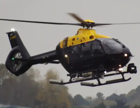
Helicopter: G-POLS
The helicopter G-POLS is used by the British police. The helicopter is deployed in pursuits, missing persons cases and other incidents where a helicopter provides added value.
Photo: James from Cheltenham, Gloucestershire
3 miles
1550 feet
132 mph
2 minutes
18:15
18:16

Route
Greenfieldmuir Road, East Renfrewshire18:16
Elderslie, Renfrewshire18:16
Neilston, East Renfrewshire18:15
Procession Road, Renfrewshire18:15
Glenfield Grange, Renfrewshire18:15
Live flights
Today
Police Helicopter to Glasgow, South Street6 Jul 23:22
Police Helicopter to South Lanarkshire6 Jul 23:09
Police Helicopter to North Weald Airfield6 Jul 22:57
Police Aircraft to East Midlands Airport6 Jul 22:56
Police Helicopter to Lochhead, A726 Jul 22:39
Flights Neilston
Police Helicopter to Neilston, Fereneze Road19 May 22:23
Police Helicopter to Glasgow, Salterland Road11 May 11:52
Police Helicopter to Neilston, Kingston Road8 May 21:40
Police Helicopter to Neilston, Gateside26 Apr 21:12
Police Helicopter to Glasgow, Doncaster Street24 Apr 21:00
Police Helicopter to Glasgow, Salterland Road13 Apr 11:36
Police Helicopter to Neilston, Craigton Road10 Apr 13:14
Police Helicopter to Neilston, Kingston Road9 Apr 18:42
Police Helicopter to Neilston, Kingston Road7 Apr 14:33
Police Helicopter to Neilston, Harelaw Road7 Apr 14:30
Helicopter flights on your website?
You can easily display helicopter flights on your own website. Use the embed code.
