Air Ambulance Helicopter to Ardersier, Old Military Road
Monday, 30 March 2026 | 16:51 | From The Fish Road (Heritage path)
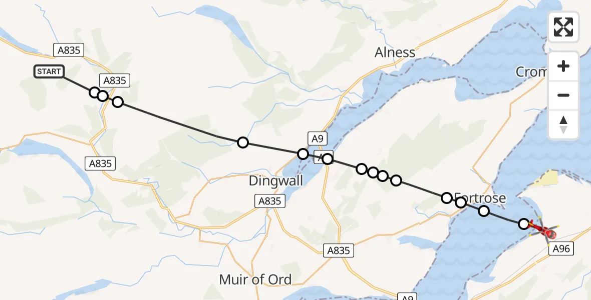
On Monday, 30 March 2026 at 16:51, a Air Ambulance Helicopter departed from The Fish Road (Heritage path) to Ardersier. It was the Air Ambulance Helicopter with registration number G-GSAS. The flight lasted 10 minutes. During that period, the aircraft travelled 28 miles at an average speed of 177 miles per hour at a maximum altitude of 3350 feet.
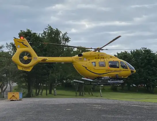
Helicopter: G-GSAS
The helicopter G-GSAS is used as a air ambulance helicopter. The main purpose of this aircraft is to transport a Mobile Medical Team to an incident as quickly as possible, enabling the trauma doctor to provide immediate first aid on site. The aircraft is flying this flight as Air Ambulance Helicopter.
Photo: Scanbus
29 miles
3350 feet
177 mph
10 minutes
16:51
17:00

Route
Old Military Road, Highland17:00
Ardersier, Highland17:00
Rosemarkie, Highland16:59
Avoch, Highland16:58
Fortrose, Highland16:58
Killen, Highland16:57
Badgrinnan, Highland16:57
Culbo Road, Highland16:57
Highland, Highland16:56
Culbokie, Highland16:56
Dingwall, Highland16:55
Heights of Brae, Highland16:54
Highland, Highland16:52
A835, Highland16:52
Achnaclerach, Highland16:51
The Fish Road (Heritage path), Highland16:51
Live flights
Today
Coastguard Helicopter to Solent Airport5 Jul 23:21
Air Ambulance Aircraft to RAF Lossiemouth5 Jul 23:17
Police Helicopter to Glasgow, Beech Avenue5 Jul 23:05
Police Aircraft to East Midlands Airport5 Jul 22:38
Air Ambulance Helicopter to North Sea5 Jul 22:14
Police Helicopter to Solihull, Centro Way5 Jul 22:09
Police Helicopter to Hawarden Airport5 Jul 21:47
Flights Ardersier
Air Ambulance Helicopter to North Sea5 Jul 20:29
Air Ambulance Helicopter to Loch Luichart1 Jul 14:53
Air Ambulance Helicopter to Ardersier29 Jun 12:34
Air Ambulance Helicopter to Inverness Airport29 Jun 08:50
Coastguard Helicopter to Inverness Airport25 Jun 16:01
Air Ambulance Helicopter to Loch Luichart13 Jun 10:42
Air Ambulance Helicopter to Tain, A911 Jun 12:26
Helicopter flights on your website?
You can easily display helicopter flights on your own website. Use the embed code.
