Air Ambulance Helicopter to Ansty CP, M6
Monday, 30 March 2026 | 14:56 | From Coventry Airport
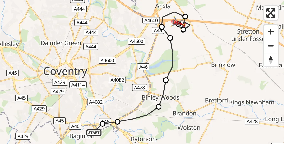
On Monday, 30 March 2026 at 14:56, a Air Ambulance Helicopter departed from Coventry Airport to Ansty CP. It was the Air Ambulance Helicopter with registration number G-WNAS. The flight lasted 5 minutes. During that period, the aircraft travelled 9 miles at an average speed of 109 miles per hour at a maximum altitude of 850 feet.
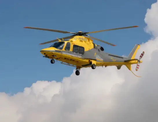
Helicopter: G-WNAS
The helicopter G-WNAS is used as an ambulance helicopter. The helicopter is equipped with a stretcher for transporting patients. The helicopter is often used to transport to hospitals.
Photo: Tony Melony
10 miles
850 feet
109 mph
6 minutes
14:56
15:01

Route
M6, West Midlands - Warwickshire15:01
Ansty CP, Warwickshire15:01
Coventry Walsgrave MTC, Coventry15:01
Rugby, Warwickshire15:00
Ansty CP, Warwickshire14:59
RAF Ansty, Coventry, Warwickshire14:59
Rugby, Warwickshire14:58
Binley Woods CP, Warwickshire14:58
Rugby, Warwickshire14:57
Coventry, Hartlepool14:57
Rowley Road, West Midlands - Warwickshire14:56
Live flights
Today
Police Helicopter to Manchester Barton Aerodrome13 Jul 23:56
Police Helicopter to Bournemouth Airport13 Jul 23:55
Air Ambulance Helicopter to Cardiff Heliport13 Jul 23:38
Police Helicopter to Birmingham Airport13 Jul 23:21
Police Helicopter to Irlam, Twelve Yards Road13 Jul 23:00
Helicopter flights on your website?
You can easily display helicopter flights on your own website. Use the embed code.
