Air Ambulance Helicopter to Highland
Monday, 30 March 2026 | 11:20 | From Inverness Airport
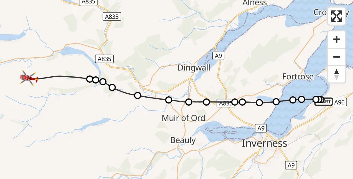
On Monday, 30 March 2026 at 11:20, a Air Ambulance Helicopter departed from Inverness Airport to Highland. It was the Air Ambulance Helicopter with registration number G-GSAS. The flight lasted 21 minutes. During that period, the aircraft travelled 32 miles at an average speed of 93 miles per hour at a maximum altitude of 1825 feet.
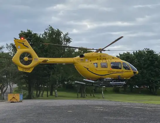
Helicopter: G-GSAS
The helicopter G-GSAS is used as a air ambulance helicopter. The main purpose of this aircraft is to transport a Mobile Medical Team to an incident as quickly as possible, enabling the trauma doctor to provide immediate first aid on site. The aircraft is flying this flight as Air Ambulance Helicopter.
Photo: Scanbus
32 miles
1825 feet
93 mph
21 minutes
11:20
11:41

Route
Highland, Highland11:41
Highland, Highland11:36
Meig Tunnel Adit, Highland11:36
Highland, Highland11:35
Contin, Highland11:35
Achonochie Road, Highland11:33
Marybank, Highland11:31
Muir of Ord, Highland11:29
Mulbuie, Highland11:28
Tore, Highland11:26
Inverness, Highland11:25
Munlochy, Highland11:24
Inverness, Highland11:23
Avoch, Highland11:22
Fortrose, Highland11:22
Inverness, Highland11:21
Dalcross Heliport11:21
Inverness, Highland11:20
Inverness Airport, Inverness11:20
Live flights
Today
Flights Highland
Air Ambulance Helicopter to Bog of Surtan4 Jul 21:06
Coastguard Helicopter to Glasgow Airport4 Jul 14:56
Air Ambulance Helicopter to Highland3 Jul 09:44
Air Ambulance Helicopter to Highland3 Jul 04:01
Air Ambulance Helicopter to Highland2 Jul 17:56
Helicopter flights on your website?
You can easily display helicopter flights on your own website. Use the embed code.
