Coastguard Helicopter to North Atlantic Ocean
Sunday, 29 March 2026 | 11:00 | From Cornwall Airport Newquay
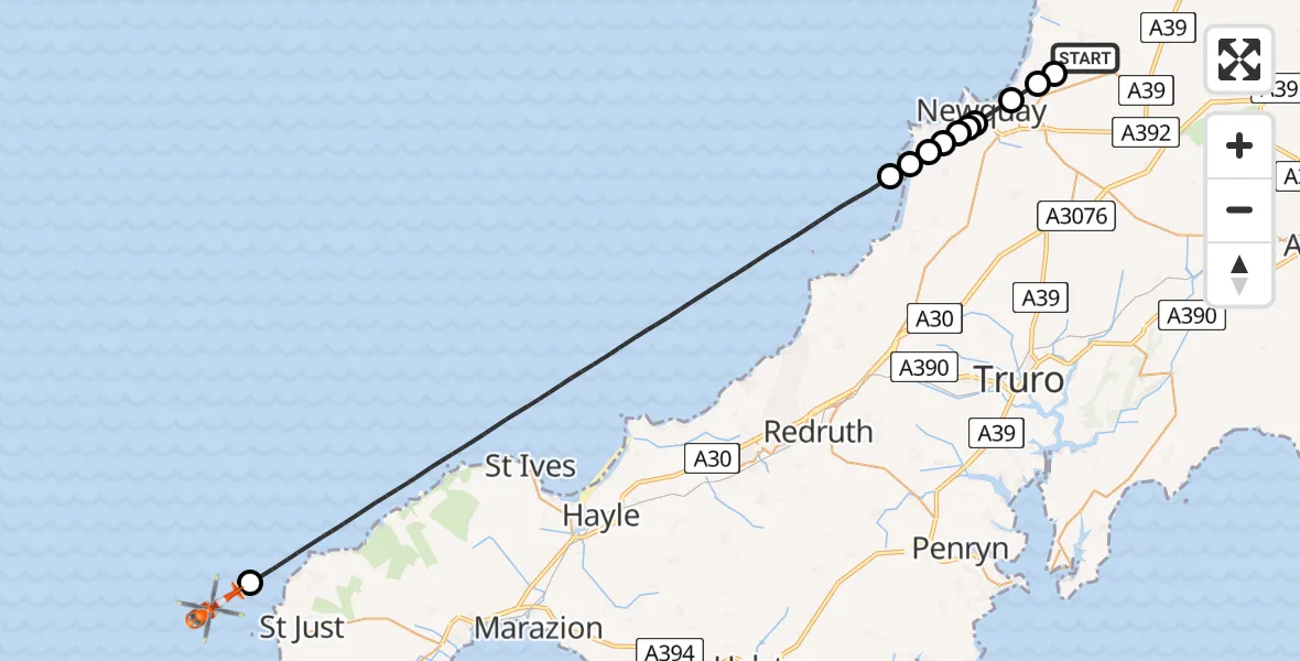
On Sunday, 29 March 2026 at 11:00, a Coastguard Helicopter departed from Cornwall Airport Newquay to North Atlantic Ocean. It was the Coastguard Helicopter with registration number G-MCGF. The flight lasted 20 minutes. During that period, the aircraft travelled 40 miles at an average speed of 121 miles per hour at a maximum altitude of 700 feet.
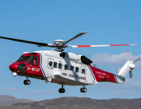
Helicopter: G-MCGF
The helicopter G-MCGF is used by the British Coastguard. The helicopter is deployed in search and rescue operations at sea, rescue operations involving ships or drilling platforms, patrols to prevent smuggling or piracy, environmental monitoring and disaster relief support.
Photo: The Carlisle Kid
40 miles
700 feet
121 mph
20 minutes
11:00
11:20

Route
North Atlantic Ocean, 11:20
North Atlantic Ocean11:19
Bristol Channel, 11:08
Bristol Channel, 11:06
Perranzabuloe, Cornwall11:06
Wheal Golden Drive, Cornwall11:06
Rhubarb Hill, Cornwall11:05
Cubert, Cornwall11:05
Halwyn Road, Cornwall11:05
Cubert, Cornwall11:05
Trevean Way, Cornwall11:05
Hilgrove Road, Cornwall11:04
Porth, Cornwall11:04
Trevelgue Farm Private Road, Cornwall11:03
B3276, Cornwall11:03
Cornwall Airport Newquay, Newquay11:02
Cornwall Airport Newquay, Newquay11:00
Live flights
Today
Helicopter flights on your website?
You can easily display helicopter flights on your own website. Use the embed code.
