Air Ambulance Helicopter to Bristol, Armada Road
Saturday, 28 March 2026 | 22:55 | From South Gloucestershire
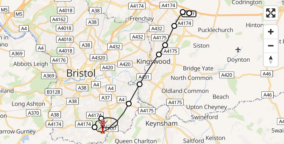
On Saturday, 28 March 2026 at 22:55, a Air Ambulance Helicopter departed from South Gloucestershire to Bristol. It was the Air Ambulance Helicopter with registration number G-WLTS. The flight lasted 10 minutes. During that period, the aircraft travelled 11 miles at an average speed of 67 miles per hour at a maximum altitude of 750 feet.
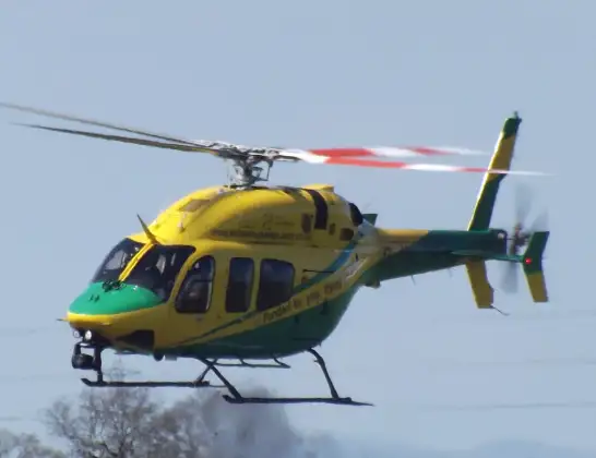
Helicopter: G-WLTS
The helicopter G-WLTS is used as a air ambulance helicopter. The main purpose of this aircraft is to transport a Mobile Medical Team to an incident as quickly as possible, enabling the trauma doctor to provide immediate first aid on site. The aircraft is flying this flight as Air Ambulance Helicopter.
Photo: James
12 miles
750 feet
67 mph
11 minutes
22:55
23:06

Route
Bristol, City of London23:06
Armada Road, Greater London - City of London23:06
Bristol, City of London23:02
Whitchurch (Hengrove) Aerodrome, Bristol23:01
Bristol, City of London23:00
Kingswood, South Gloucestershire22:59
Bristol, South Gloucestershire22:58
Kingswood, South Gloucestershire22:58
Bristol, South Gloucestershire22:58
Emerson Way, South Gloucestershire22:57
South Gloucestershire, South Gloucestershire22:57
Lily Road, South Gloucestershire22:56
South Gloucestershire, South Gloucestershire22:55
Live flights
Today
Police Helicopter to Falkirk02:12:08
Flights Bristol
Police Helicopter to Bristol, Diana Gardens14 Jul 00:58
Police Helicopter to Bristol, Oaktree Crescent10 Jul 12:36
Police Helicopter to Bristol, Stoke Lane9 Jul 20:52
Helicopter flights on your website?
You can easily display helicopter flights on your own website. Use the embed code.
