Air Ambulance Helicopter to Beddgelert, Pyg Track
Saturday, 28 March 2026 | 14:59 | From Caernarfon Airport

On Saturday, 28 March 2026 at 14:59, a Air Ambulance Helicopter departed from Caernarfon Airport to Beddgelert. It was the Air Ambulance Helicopter with registration number G-WOBR. The flight lasted 10 minutes. During that period, the aircraft travelled 16 miles at an average speed of 94 miles per hour at a maximum altitude of 3000 feet.
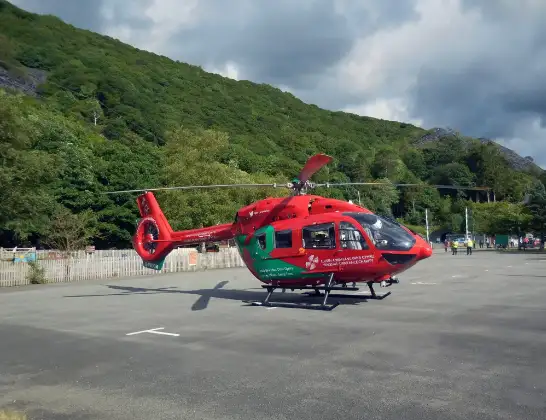
Helicopter: G-WOBR
The helicopter G-WOBR is used as a air ambulance helicopter. The main purpose of this aircraft is to transport a Mobile Medical Team to an incident as quickly as possible, enabling the trauma doctor to provide immediate first aid on site. The aircraft is flying this flight as Air Ambulance Helicopter.
Photo: Hefin Owen
17 miles
3000 feet
94 mph
11 minutes
14:59
15:09

Route
Pyg Track, Gwynedd15:09
Beddgelert, Gwynedd15:09
Llanberis Pass, Gwynedd15:09
Cylchdaith yr Wyddfa, Gwynedd15:08
Llanberis, Gwynedd15:08
Snowdon Ranger Path, Gwynedd15:08
Rhyd Ddu Path, Gwynedd15:06
Cwm Caregog, Gwynedd15:06
Rhyd Ddu Path, Gwynedd15:05
Cwellyn, Gwynedd15:05
A4085, Gwynedd15:04
Gwynedd, Gwynedd15:04
Rhosgadfan, Gwynedd15:03
Rhostryfan, Gwynedd15:03
Llanwnda, Gwynedd15:02
Llanfaglan, Gwynedd15:02
Llandwrog, Gwynedd15:01
Caernarfon Airport, Caernarfon14:59
Live flights
Today
Flights Beddgelert
Coastguard Helicopter to Beddgelert, Pyg Track24 May 14:59
Coastguard Helicopter to Beddgelert, Pyg Track24 May 14:51
Coastguard Helicopter to Beddgelert, Pyg Track24 May 14:47
Coastguard Helicopter to Beddgelert, Pyg Track24 May 14:42
Coastguard Helicopter to Beddgelert, Crib Goch24 May 14:02
Coastguard Helicopter to Beddgelert, Crib Goch24 May 13:49
Coastguard Helicopter to Caernarfon Airport18 May 16:22
Helicopter flights on your website?
You can easily display helicopter flights on your own website. Use the embed code.
