Coastguard Helicopter to Penrhos Garnedd, Penrhos Road
Saturday, 28 March 2026 | 14:56 | From Llanberis
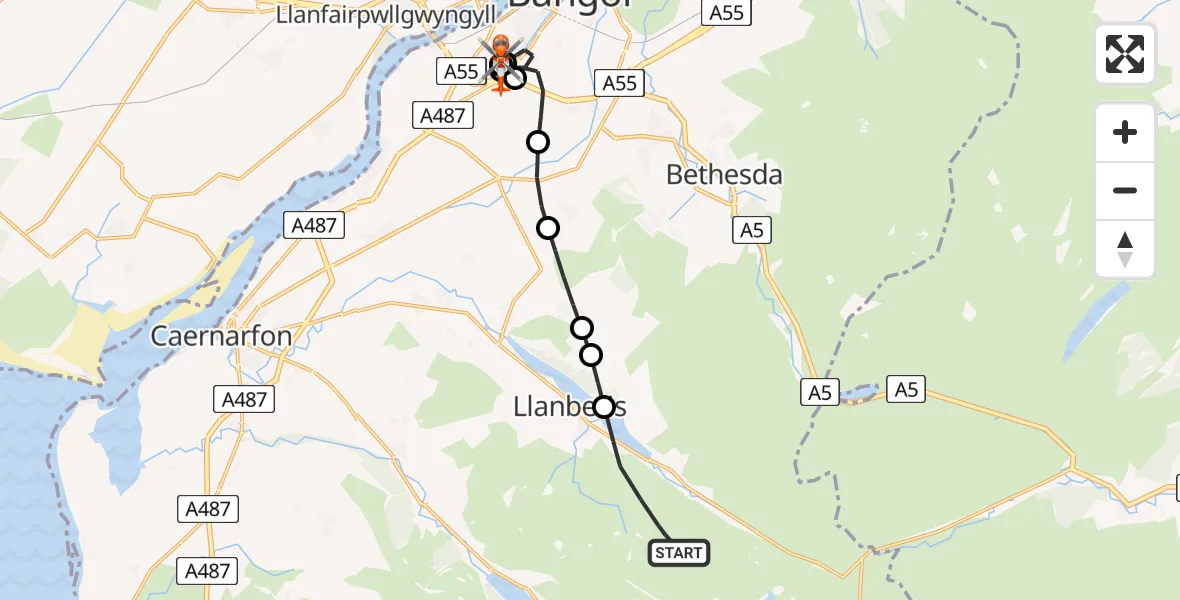
On Saturday, 28 March 2026 at 14:56, a Coastguard Helicopter departed from Llanberis to Penrhos Garnedd. It was the Coastguard Helicopter with registration number G-MCGI. The flight lasted 45 minutes. During that period, the aircraft travelled 11 miles at an average speed of 16 miles per hour at a maximum altitude of 2325 feet.
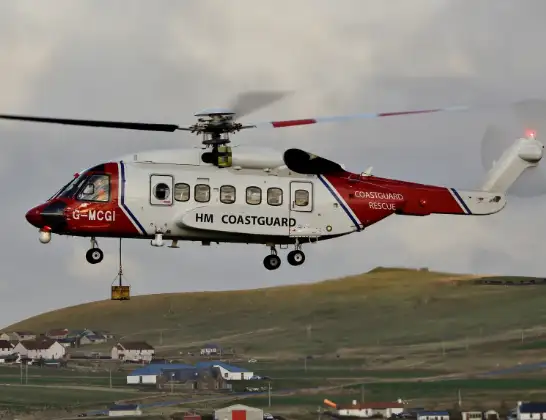
Helicopter: G-MCGI
The helicopter G-MCGI is used by the British Coastguard. The helicopter is deployed in search and rescue operations at sea, rescue operations involving ships or drilling platforms, patrols to prevent smuggling or piracy, environmental monitoring and disaster relief support.
Photo: CG Rescue G-MCGI MG 0869.jpg by Ronnie Robertson Licensed under CC BY-SA 2.0 Source: https://commons.wikimedia.org/wiki/File:CG_Rescue_G-MCGI_MG_0869.jpg
12 miles
2325 feet
16 mph
45 minutes
14:56
15:40

Route
Penrhos Garnedd, Gwynedd15:40
Penrhos Road, Gwynedd15:31
Penrhos Road, Gwynedd15:30
Ysbyty Gwynedd Hospital Heliport15:29
Penrhos Road, Gwynedd15:29
Penrhos Garnedd, Gwynedd15:29
Caerhun, Gwynedd15:27
Penrhos Garnedd, Gwynedd15:27
Caerhun, Gwynedd15:25
Rhiwlas, Gwynedd15:25
Deiniolen, Gwynedd15:23
Llanberis, Gwynedd15:23
Dinorwig, Gwynedd15:23
Llanberis Path, Gwynedd15:21
Llanberis, Gwynedd14:56
Live flights
Today
Police Helicopter to Manchester Barton Aerodrome13 Jul 23:56
Police Helicopter to Bournemouth Airport13 Jul 23:55
Air Ambulance Helicopter to Cardiff Heliport13 Jul 23:38
Police Helicopter to Harborough, Sulby Road13 Jul 23:36
Police Helicopter to Birmingham Airport13 Jul 23:21
Flights Llanberis
Air Ambulance Helicopter to Llanberis, A40865 Jul 14:22
Coastguard Helicopter to Caernarfon Airport26 Jun 11:54
Coastguard Helicopter to Llanberis, Dinorwig26 Jun 09:13
Coastguard Helicopter to Llanberis, A408626 May 19:16
Helicopter flights on your website?
You can easily display helicopter flights on your own website. Use the embed code.
