Air Ambulance Helicopter to Salisbury Terrace, Middlesbrough
Saturday, 28 March 2026 | 12:30 | From Egglescliffe
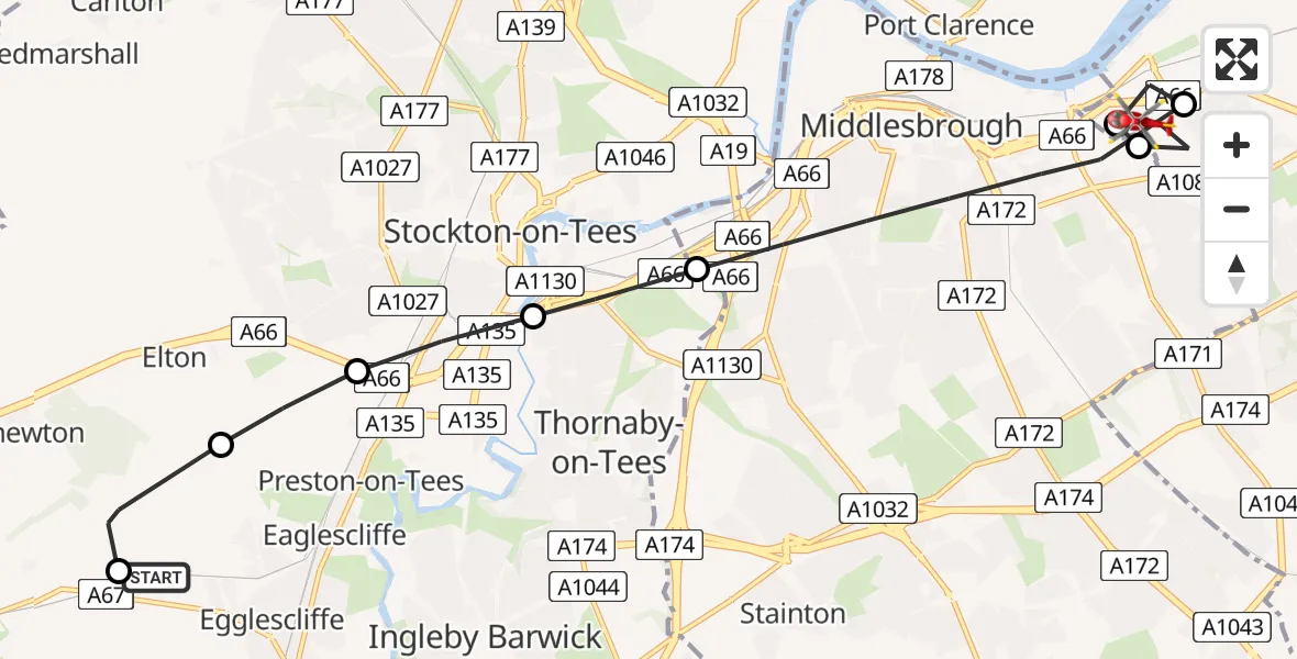
On Saturday, 28 March 2026 at 12:30, a Air Ambulance Helicopter departed from Egglescliffe to Salisbury Terrace. It was the Air Ambulance Helicopter with registration number G-NHAE. The flight lasted 6 minutes. During that period, the aircraft travelled 12 miles at an average speed of 123 miles per hour at a maximum altitude of 1025 feet.
Helicopter: G-NHAE
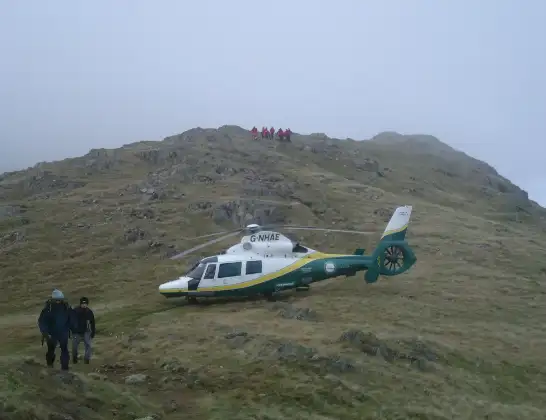
The helicopter G-NHAE is used as a air ambulance helicopter. The main purpose of this aircraft is to transport a Mobile Medical Team to an incident as quickly as possible, enabling the trauma doctor to provide immediate first aid on site. The aircraft is flying this flight as Air Ambulance Helicopter.
Photo: Michael Earnshaw
12 miles
1025 feet
123 mph
6 minutes
12:30
12:36

Route
Middlesbrough, Redcar and Cleveland12:36
Salisbury Terrace, Redcar and Cleveland12:35
Middlesbrough, Middlesbrough12:35
Salisbury Terrace, Redcar and Cleveland12:34
Middlesbrough, Middlesbrough12:33
Thornaby-on-Tees, Stockton-on-Tees12:32
Stockton-on-Tees, Stockton-on-Tees12:32
Elton, Stockton-on-Tees12:31
Longnewton, Stockton-on-Tees12:31
Longnewton Lane, Stockton-on-Tees12:30
Live flights
Today
Police Helicopter to Glasgow, South Street6 Jul 23:22
Police Helicopter to South Lanarkshire6 Jul 23:09
Police Helicopter to North Weald Airfield6 Jul 22:57
Police Aircraft to East Midlands Airport6 Jul 22:56
Police Helicopter to Lochhead, A726 Jul 22:39
Flights Egglescliffe
Air Ambulance Helicopter to Newton Aycliffe3 Jul 08:45
Helicopter flights on your website?
You can easily display helicopter flights on your own website. Use the embed code.
