Air Ambulance Helicopter to North Baddesley, Bracken Road
Friday, 27 March 2026 | 22:02 | From Thruxton Aerodrome
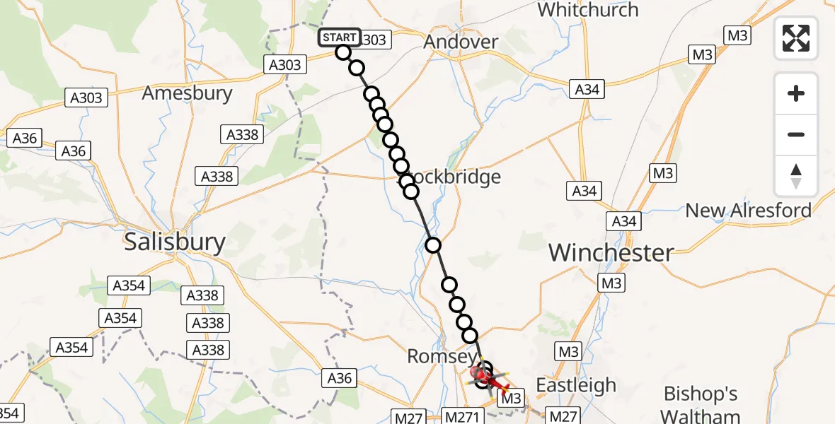
On Friday, 27 March 2026 at 22:02, a Air Ambulance Helicopter departed from Thruxton Aerodrome to North Baddesley. It was the Air Ambulance Helicopter with registration number G-HIOW. The flight lasted 11 minutes. During that period, the aircraft travelled 22 miles at an average speed of 123 miles per hour at a maximum altitude of 1350 feet.
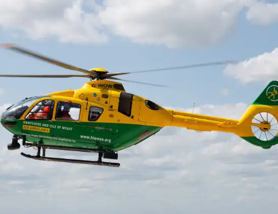
Helicopter: G-HIOW
The helicopter G-HIOW is used as a air ambulance helicopter. The main purpose of this aircraft is to transport a Mobile Medical Team to an incident as quickly as possible, enabling the trauma doctor to provide immediate first aid on site. The aircraft is flying this flight as Air Ambulance Helicopter.
Photo: JF2608
22 miles
1350 feet
123 mph
11 minutes
22:02
22:13

Route
North Baddesley, Hampshire22:13
Bracken Road, Hampshire22:13
Copse Close, Hampshire22:12
Mulberry Street, Hampshire22:12
Queens Ride, Hampshire22:11
Hoe Lane, Hampshire22:11
North Baddesley, Hampshire22:09
Crampmoor, Hampshire22:09
Braishfield, Hampshire22:08
Test Valley, Hampshire22:08
Michelmersh, Hampshire22:08
King's Somborne, Hampshire22:07
Houghton, Hampshire22:06
Test Valley, Hampshire22:06
Nether Wallop, Hampshire22:05
Test Valley, Hampshire22:05
Nether Wallop, Hampshire22:05
Middle Wallop Airfield, Middle Wallop22:05
Test Valley, Hampshire22:04
Abbotts Ann, Hampshire22:04
Amport, Hampshire22:04
Grateley, Hampshire22:03
Thruxton, Hampshire22:03
Snoddington Lane, Hampshire22:02
Live flights
Police Helicopter on its way from RAF Benson12 Jul 22:54
Police Helicopter on its way from Dundrod12 Jul 22:50
Today
Air Ambulance Helicopter to Glasgow Airport12 Jul 22:48
Police Helicopter to Walton Wood Airfield12 Jul 22:44
Air Ambulance Helicopter to Norwich Airport12 Jul 22:27
Air Ambulance Helicopter to Northrepps Aerodrome12 Jul 22:23
Helicopter flights on your website?
You can easily display helicopter flights on your own website. Use the embed code.
