Air Ambulance Helicopter to RAF Benson
Friday, 27 March 2026 | 17:28 | From Bicester Airfield
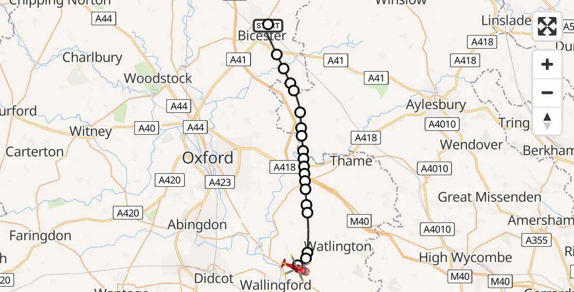
On Friday, 27 March 2026 at 17:28, a Air Ambulance Helicopter departed from Bicester Airfield to RAF Benson. It was the Air Ambulance Helicopter with registration number G-TVLY. The flight lasted 10 minutes. During that period, the aircraft travelled 22 miles at an average speed of 130 miles per hour at a maximum altitude of 1250 feet.
Helicopter: G-TVLY
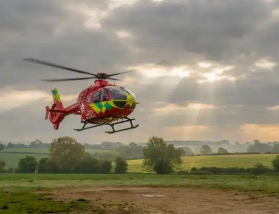
The helicopter G-TVLY is used as a air ambulance helicopter. The main purpose of this aircraft is to transport a Mobile Medical Team to an incident as quickly as possible, enabling the trauma doctor to provide immediate first aid on site. The aircraft is flying this flight as Air Ambulance Helicopter.
Photo: Tony Melony
22 miles
1250 feet
130 mph
10 minutes
17:28
17:38

Route
RAF Benson, Wallingford, Oxfordshire17:38
RAF Benson, Wallingford, Oxfordshire17:37
Ewelme, Oxfordshire17:37
Cuxham, Oxfordshire17:37
Chalgrove, Oxfordshire17:35
South Oxfordshire, Oxfordshire17:35
Great Haseley, Oxfordshire17:35
Great Milton, Oxfordshire17:34
Waterstock, Oxfordshire17:34
Tiddington, Oxfordshire17:34
Waterstock, Oxfordshire17:34
Ickford, Buckinghamshire17:33
Worminghall, Buckinghamshire17:33
Oakley Microlight Airfield, Aylesbury, Buckinghamshire17:32
Oakley, Buckinghamshire17:32
Boarstall, Buckinghamshire17:31
Cherwell, Oxfordshire17:31
Arncott, Oxfordshire17:31
Ambrosden, Oxfordshire17:30
Bicester, Oxfordshire17:28
Skimmingdish Lane, Oxfordshire17:28
Live flights
Today
Police Helicopter to Newton, A6900:15:55
Police Helicopter to North Weald Airfield29 May 23:59
Police Helicopter to Benson, Brook Street29 May 23:53
Police Helicopter to Newton, B653029 May 23:22
Air Ambulance Helicopter to Norwich Airport29 May 23:03
Police Helicopter to Almondsbury Helicopter Base29 May 22:46
Helicopter flights on your website?
You can easily display helicopter flights on your own website. Use the embed code.
