Air Ambulance Helicopter to Spennymoor, Middridge Road
Friday, 27 March 2026 | 12:59 | From South Pelaw
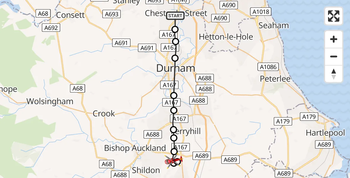
On Friday, 27 March 2026 at 12:59, a Air Ambulance Helicopter departed from South Pelaw to Spennymoor. It was the Air Ambulance Helicopter with registration number G-NHAE. The flight lasted 6 minutes. During that period, the aircraft travelled 16 miles at an average speed of 155 miles per hour at a maximum altitude of 1450 feet.
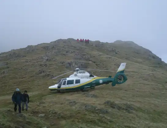
Helicopter: G-NHAE
The helicopter G-NHAE is used as a air ambulance helicopter. The main purpose of this aircraft is to transport a Mobile Medical Team to an incident as quickly as possible, enabling the trauma doctor to provide immediate first aid on site. The aircraft is flying this flight as Air Ambulance Helicopter.
Photo: Michael Earnshaw
16 miles
1450 feet
155 mph
7 minutes
12:59
13:05

Route
Middridge Road, County Durham13:05
Spennymoor, County Durham13:04
Rushyford, County Durham13:04
Spennymoor, County Durham13:03
Kirk Merrington, County Durham13:03
Spennymoor, County Durham13:03
Tudhoe, County Durham13:02
Croxdale, County Durham13:01
Durham, County Durham13:00
Pity Me, County Durham13:00
Chester Moor, County Durham12:59
Lynn Street, County Durham12:59
Live flights
Today
Police Helicopter to Glasgow, South Street6 Jul 23:22
Police Helicopter to South Lanarkshire6 Jul 23:09
Police Helicopter to North Weald Airfield6 Jul 22:57
Police Aircraft to East Midlands Airport6 Jul 22:56
Police Helicopter to Lochhead, A726 Jul 22:39
Flights Spennymoor
Police Helicopter to Spennymoor, Merrington Road17 Apr 05:03
Police Helicopter to Spennymoor, Merrington Road17 Apr 05:03
Police Helicopter to Spennymoor, Merrington Road17 Apr 05:03
Police Helicopter to Spennymoor, Merrington Road17 Apr 05:03
Police Helicopter to Spennymoor, Merrington Road17 Apr 05:03
Police Helicopter to Spennymoor, Merrington Road17 Apr 05:03
Police Helicopter to Spennymoor, Merrington Road17 Apr 05:03
Police Helicopter to Spennymoor, Merrington Road17 Apr 05:03
Police Helicopter to Spennymoor, Merrington Road17 Apr 05:03
Police Helicopter to Spennymoor, Merrington Road17 Apr 05:03
Helicopter flights on your website?
You can easily display helicopter flights on your own website. Use the embed code.
