Air Ambulance Helicopter to Coventry Airport
Friday, 27 March 2026 | 9:22 | From Coventry Airport
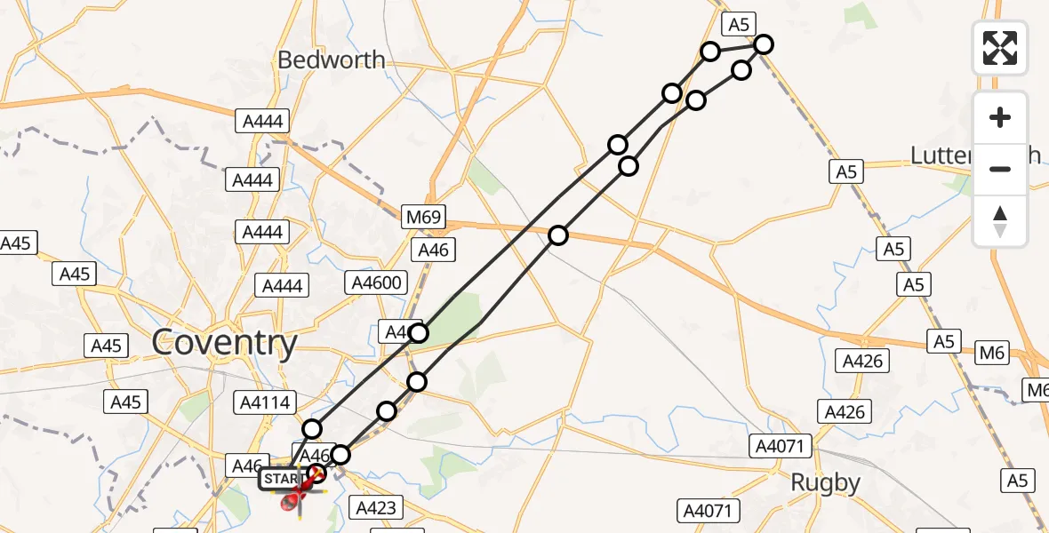
On Friday, 27 March 2026 at 9:22, a Air Ambulance Helicopter departed from Coventry Airport to Coventry Airport. It was the Air Ambulance Helicopter with registration number G-WNAS. The flight lasted 10 minutes. During that period, the aircraft travelled 23 miles at an average speed of 136 miles per hour at a maximum altitude of 875 feet.
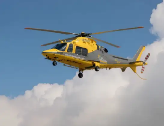
Helicopter: G-WNAS
The helicopter G-WNAS is used as an ambulance helicopter. The helicopter is equipped with a stretcher for transporting patients. The helicopter is often used to transport to hospitals.
Photo: Tony Melony
23 miles
875 feet
136 mph
11 minutes
09:22
09:32

Route
Coventry Airport, Coventry, West Midlands09:32
Coventry Airport, Coventry, West Midlands09:32
Rugby, West Midlands09:31
Coventry, Coventry09:30
Binley Woods CP, Rugby09:30
Rugby, Rugby09:28
Withybrook CP, Rugby09:28
Monks Kirby CP, Rugby09:27
Wibtoft CP, Rugby09:26
Claybrooke Parva, Harborough09:26
Rugby, Rugby09:26
Monks Kirby CP, Rugby09:25
Withybrook CP, Rugby09:25
Rugby, Rugby09:23
Coventry, Coventry09:22
Baginton, Warwick09:22
Live flights
Today
Helicopter flights on your website?
You can easily display helicopter flights on your own website. Use the embed code.
