Air Ambulance Helicopter to Basingstoke, Brighton Way
Thursday, 26 March 2026 | 8:39 | From Penton Grafton
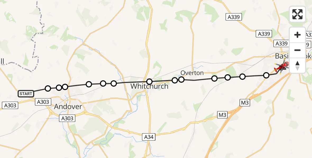
On Thursday, 26 March 2026 at 8:39, a Air Ambulance Helicopter departed from Penton Grafton to Basingstoke. It was the Air Ambulance Helicopter with registration number G-HIOW. The flight lasted 14 minutes. During that period, the aircraft travelled 24 miles at an average speed of 104 miles per hour at a maximum altitude of 1225 feet.
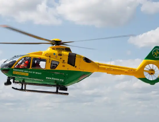
Helicopter: G-HIOW
The helicopter G-HIOW is used as a air ambulance helicopter. The main purpose of this aircraft is to transport a Mobile Medical Team to an incident as quickly as possible, enabling the trauma doctor to provide immediate first aid on site. The aircraft is flying this flight as Air Ambulance Helicopter.
Photo: JF2608
24 miles
1225 feet
104 mph
14 minutes
08:39
08:53

Route
Basingstoke, Basingstoke and Deane08:53
Brighton Way, Basingstoke and Deane08:52
Winchester Road, Basingstoke and Deane08:51
Delius Close, Basingstoke and Deane08:50
Basingstoke, Basingstoke and Deane08:47
Oakley, Basingstoke and Deane08:47
Deane, Basingstoke and Deane08:46
Ashe, Basingstoke and Deane08:46
Overton, Basingstoke and Deane08:45
Basingstoke and Deane, Basingstoke and Deane08:44
Whitchurch, Basingstoke and Deane08:44
Hurstbourne Priors, Basingstoke and Deane08:42
St. Mary Bourne, Basingstoke and Deane08:42
Picket Piece, Test Valley08:42
Enham Alamein, Andover08:41
Test Valley, Test Valley08:41
Penton Mewsey, Test Valley08:40
Penton Grafton, Test Valley08:39
Live flights
Today
Flights Basingstoke
Air Ambulance Helicopter to Southampton Airport23 Jun 23:52
Police Helicopter to Basingstoke, Wayside Road21 Jun 14:22
Helicopter flights on your website?
You can easily display helicopter flights on your own website. Use the embed code.
