Air Ambulance Helicopter to Horeston Grange, Gadsby Street
Thursday, 26 March 2026 | 8:08 | From King's Newnham CP
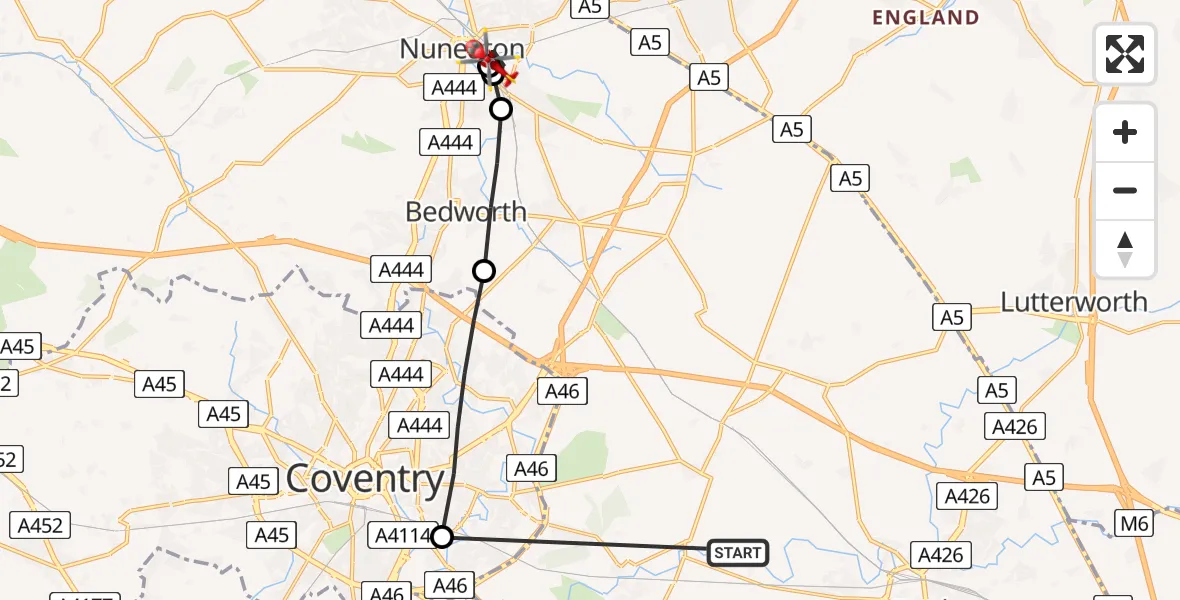
On Thursday, 26 March 2026 at 8:08, a Air Ambulance Helicopter departed from King's Newnham CP to Horeston Grange. It was the Air Ambulance Helicopter with registration number G-WNAS. The flight lasted 5 minutes. During that period, the aircraft travelled 15 miles at an average speed of 175 miles per hour at a maximum altitude of 925 feet.
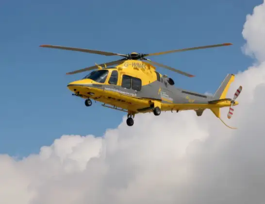
Helicopter: G-WNAS
The helicopter G-WNAS is used as an ambulance helicopter. The helicopter is equipped with a stretcher for transporting patients. The helicopter is often used to transport to hospitals.
Photo: Tony Melony
16 miles
925 feet
175 mph
6 minutes
08:08
08:13

Route
Gadsby Street, Nuneaton and Bedworth08:13
Nuneaton, Nuneaton and Bedworth08:13
Horeston Grange, Nuneaton and Bedworth08:12
Nuneaton, Nuneaton and Bedworth08:11
Bedworth, Nuneaton and Bedworth08:10
Coventry, Coventry08:08
Kings Newnham Lane, Rugby08:08
Live flights
Police Helicopter on its way from Ewelme13 Jul 22:24
Today
Police Helicopter to Manchester Barton Aerodrome13 Jul 23:56
Police Helicopter to Bournemouth Airport13 Jul 23:55
Air Ambulance Helicopter to Cardiff Heliport13 Jul 23:38
Police Helicopter to Birmingham Airport13 Jul 23:21
Police Helicopter to Irlam, Twelve Yards Road13 Jul 23:00
Helicopter flights on your website?
You can easily display helicopter flights on your own website. Use the embed code.
