Air Ambulance Helicopter to Sywell Aerodrome
Wednesday, 25 March 2026 | 12:10 | From Coventry Airport
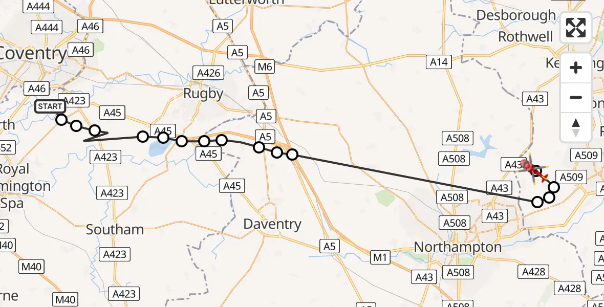
On Wednesday, 25 March 2026 at 12:10, a Air Ambulance Helicopter departed from Coventry Airport to Sywell Aerodrome. It was the Air Ambulance Helicopter with registration number G-WNAS. The flight lasted 12 minutes. During that period, the aircraft travelled 37 miles at an average speed of 181 miles per hour at a maximum altitude of 1575 feet.
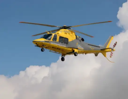
Helicopter: G-WNAS
The helicopter G-WNAS is used as an ambulance helicopter. The helicopter is equipped with a stretcher for transporting patients. The helicopter is often used to transport to hospitals.
Photo: Tony Melony
37 miles
1575 feet
181 mph
13 minutes
12:10
12:22

Route
Sywell Aerodrome, Northampton, Northamptonshire12:22
Sywell, Sywell12:22
Mears Ashby, Mears Ashby12:20
Northampton, Northampton12:20
Mears Ashby, Mears Ashby12:20
Watford, Watford12:15
Ashby St Ledgers, Ashby St Ledgers12:15
Kilsby, Kilsby12:14
Barby, Barby12:13
Onley, Onley12:13
Dunchurch, Rugby12:13
Thurlaston CP, Rugby12:12
Draycote, Rugby12:12
Princethorpe CP, Rugby12:11
Wappenbury, Warwick12:11
Bubbenhall, Warwick12:10
Samaritan Way, Warwick12:10
Live flights
Police Helicopter on its way from Dundrod12 Jul 22:50
Today
Police Helicopter to East Ardsley, Stoney Lane12 Jul 23:51
Police Helicopter to Birmingham Airport12 Jul 23:46
Police Helicopter to Parkham Ash12 Jul 23:41
Air Ambulance Helicopter to Newlands of Culloden12 Jul 23:24
Helicopter flights on your website?
You can easily display helicopter flights on your own website. Use the embed code.
