Air Ambulance Helicopter to Blackburn, Arran Avenue
Tuesday, 24 March 2026 | 15:11 | From Sagar Holme
On Tuesday, 24 March 2026 at 15:11, a Air Ambulance Helicopter departed from Sagar Holme to Blackburn. It was the Air Ambulance Helicopter with registration number G-NWAA. The flight lasted 12 minutes. During that period, the aircraft travelled 34 miles at an average speed of 176 miles per hour at a maximum altitude of 2325 feet.
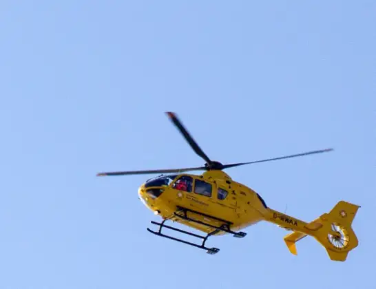
Helicopter: G-NWAA
The helicopter G-NWAA is used as a air ambulance helicopter. The main purpose of this aircraft is to transport a Mobile Medical Team to an incident as quickly as possible, enabling the trauma doctor to provide immediate first aid on site. The aircraft is flying this flight as Air Ambulance Helicopter.
Photo: David P Howard
35 miles
2325 feet
176 mph
12 minutes
15:11
15:23

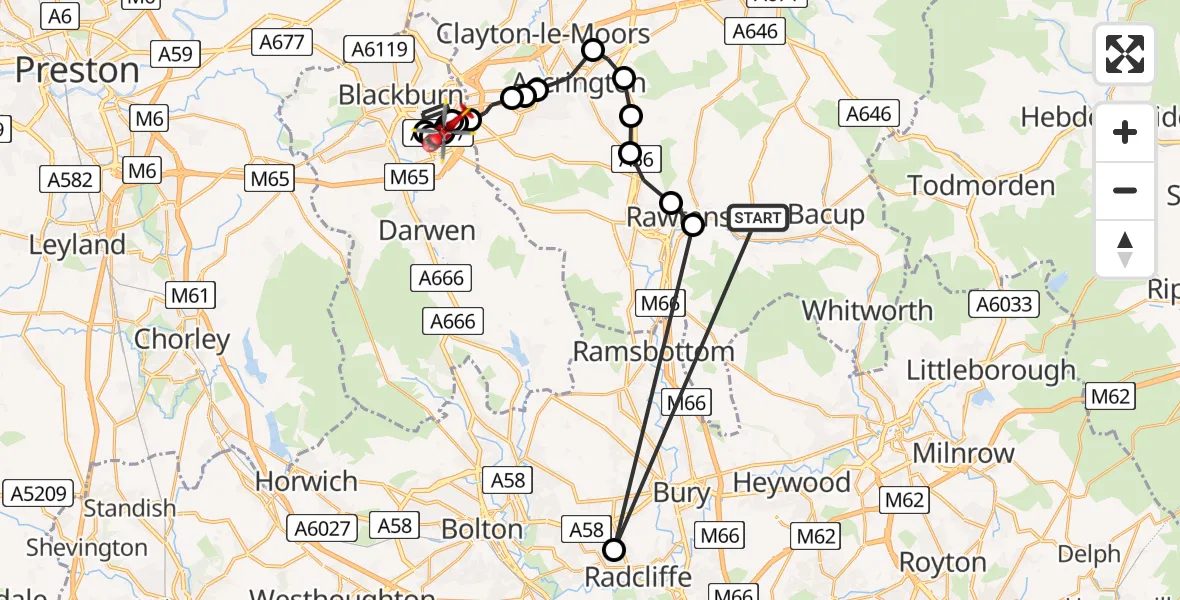
Route
Arran Avenue, Lancashire15:23
Guide, Lancashire15:22
Blackburn, Lancashire15:21
Guide, Lancashire15:21
Blackburn, Lancashire15:19
Guide, Lancashire15:19
Blackburn, Lancashire15:18
Guide, Lancashire15:18
Knuzden Brook, Hyndburn15:18
Stanhill, Hyndburn15:16
Oswaldtwistle, Hyndburn15:16
Church, Hyndburn15:16
Accrington, Hyndburn15:14
Huncoat, Hyndburn15:14
Baxenden, Hyndburn15:13
Rising Bridge, Rossendale15:13
Haslingden, Rossendale15:12
Rawtenstall, Rossendale15:12
Radcliffe, Radcliffe15:11
Fairfield Avenue, Rossendale15:11
Live flights
Police Helicopter on its way from Coopersale6 Jul 22:57
Today
Police Helicopter to Lochhead, A726 Jul 22:39
Air Ambulance Aircraft to Greenigoe6 Jul 21:45
Coastguard Helicopter to Humberside Airport6 Jul 21:43
Air Ambulance Helicopter to RAF Northolt6 Jul 21:24
Police Helicopter to Birmingham Airport6 Jul 21:17
Flights Blackburn
Air Ambulance Helicopter to Blackpool Airport21 Jun 20:33
Police Helicopter to Manchester Barton Aerodrome18 Jun 16:31
Police Helicopter to Blackburn, Montague Street18 Jun 16:19
Air Ambulance Helicopter to Blackpool Airport14 Jun 14:42
Air Ambulance Helicopter to Blackpool Airport23 May 13:31
Air Ambulance Helicopter to Blackpool Airport20 May 13:38
Helicopter flights on your website?
You can easily display helicopter flights on your own website. Use the embed code.
