Air Ambulance Helicopter to Preston on Stour CP, Shipston Road
Tuesday, 24 March 2026 | 14:18 | From Coventry Airport
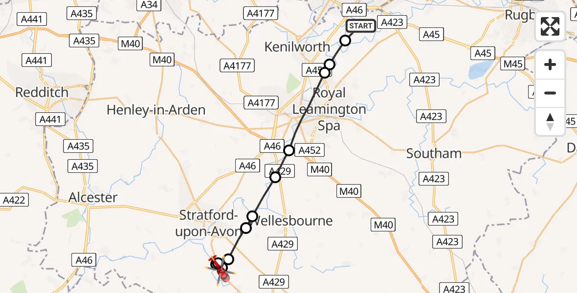
On Tuesday, 24 March 2026 at 14:18, a Air Ambulance Helicopter departed from Coventry Airport to Preston on Stour CP. It was the Air Ambulance Helicopter with registration number G-WNAS. The flight lasted 9 minutes. During that period, the aircraft travelled 18 miles at an average speed of 116 miles per hour at a maximum altitude of 1225 feet.
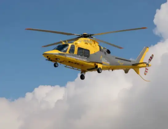
Helicopter: G-WNAS
The helicopter G-WNAS is used as an ambulance helicopter. The helicopter is equipped with a stretcher for transporting patients. The helicopter is often used to transport to hospitals.
Photo: Tony Melony
18 miles
1225 feet
116 mph
10 minutes
14:18
14:27

Route
Shipston Road, Stratford-on-Avon14:27
Preston on Stour CP, Stratford-on-Avon14:27
Atherstone on Stour CP, Stratford-on-Avon14:27
Alderminster CP, Stratford-on-Avon14:26
Atherstone on Stour CP, Stratford-on-Avon14:26
Stratford-upon-Avon, Stratford-on-Avon14:25
Alveston, Stratford-on-Avon14:24
Hampton Lucy CP, Stratford-on-Avon14:23
Barford, Warwick14:22
Warwick, Warwick14:20
Ashow, Warwick14:20
Stoneleigh, Warwick14:19
Silver Eagle Way, Warwick14:18
Live flights
Air Ambulance Helicopter on its way from Ashford14 Jul 23:46
Coastguard Helicopter on its way from North Sea14 Jul 23:44
Today
Police Helicopter to Johnstone, Gordon Square14 Jul 23:38
Coastguard Helicopter to North Sea14 Jul 23:30
Police Helicopter to Inner Seas14 Jul 23:12
Air Ambulance Helicopter to Norwich Airport14 Jul 22:52
Police Helicopter to Manchester Barton Aerodrome14 Jul 22:50
Police Helicopter to Sewardstonebury, Bury Road14 Jul 22:44
Air Ambulance Helicopter to Cardiff Heliport14 Jul 22:43
Helicopter flights on your website?
You can easily display helicopter flights on your own website. Use the embed code.
