Air Ambulance Helicopter to Cardiff Heliport
Monday, 23 March 2026 | 16:59 | From MOD St Athan
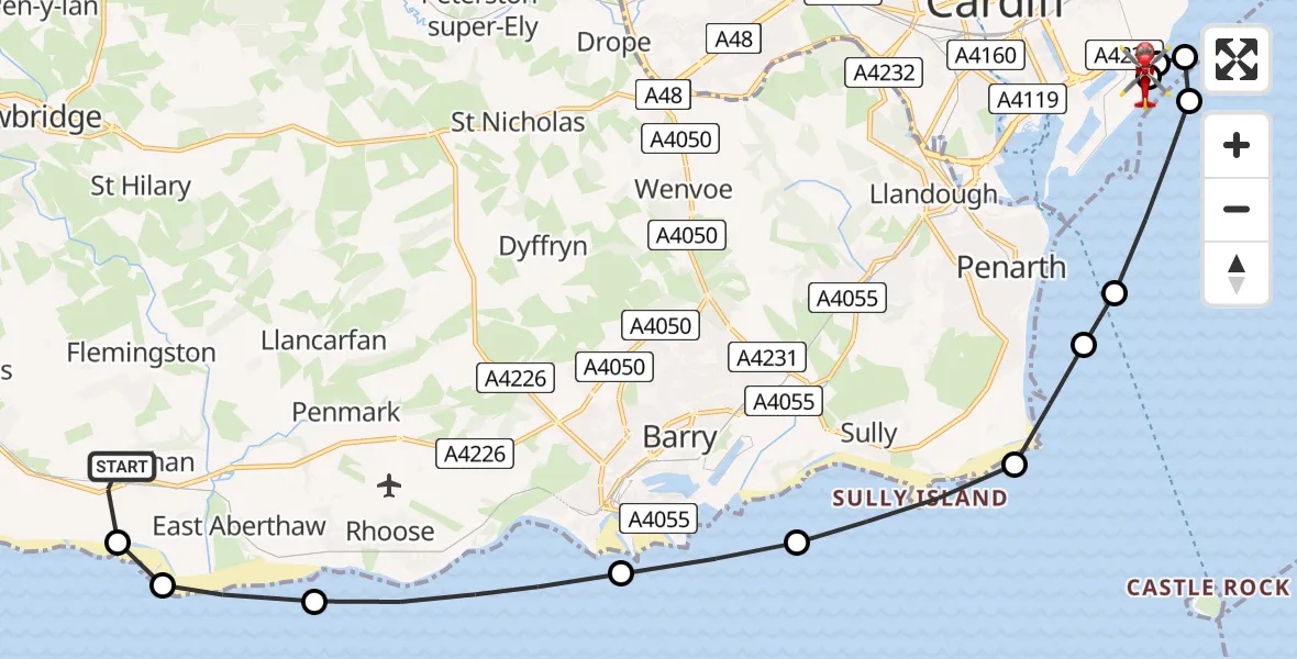
On Monday, 23 March 2026 at 16:59, a Air Ambulance Helicopter departed from MOD St Athan to Cardiff Heliport. It was the Air Ambulance Helicopter with registration number G-WROL. The flight lasted 10 minutes. During that period, the aircraft travelled 18 miles at an average speed of 114 miles per hour at a maximum altitude of 825 feet.

Helicopter: G-WROL
The helicopter G-WROL is used as a air ambulance helicopter. The main purpose of this aircraft is to transport a Mobile Medical Team to an incident as quickly as possible, enabling the trauma doctor to provide immediate first aid on site. The aircraft is flying this flight as Air Ambulance Helicopter.
Photo: James from Cheltenham, Gloucestershire
19 miles
825 feet
114 mph
10 minutes
16:59
17:08

Route
Cardiff Heliport, Cardiff17:08
Cardiff Heliport, Cardiff17:07
Cardiff, Cardiff17:07
Tremorfa, Tremorfa17:07
Cardiff, Cardiff17:06
Bristol Channel17:05
Penarth, Penarth17:05
Sully and Lavernock, Sully and Lavernock17:04
Sully, Sully17:03
Barry, Barry17:02
Rhoose, Rhoose17:01
West Aberthaw, West Aberthaw17:00
Gileston, Gileston17:00
MOD St Athan, St Athan, Vale of Glamorgan16:59
Live flights
Today
Helicopter flights on your website?
You can easily display helicopter flights on your own website. Use the embed code.
