Police Helicopter to North Weald Airfield
Monday, 23 March 2026 | 16:46 | From Coopersale
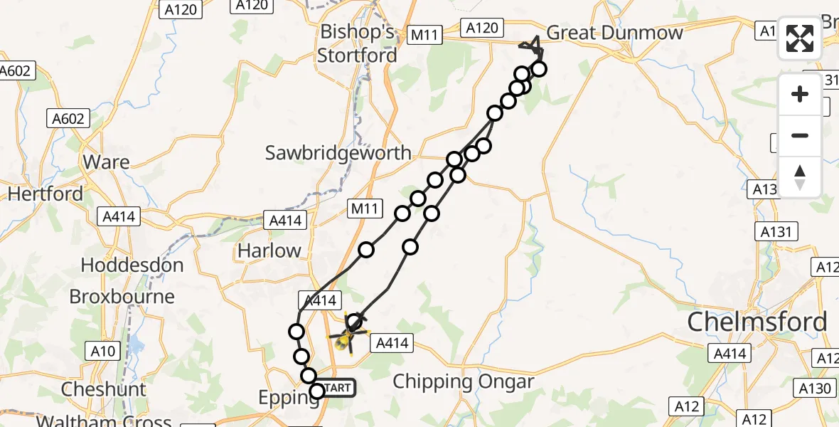
On Monday, 23 March 2026 at 16:46, a Police Helicopter departed from Coopersale to North Weald Airfield. It was the Police Helicopter with registration number G-TVHB. The flight lasted 15 minutes. During that period, the aircraft travelled 30 miles at an average speed of 117 miles per hour at a maximum altitude of 650 feet.
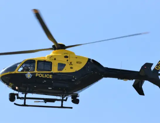
Helicopter: G-TVHB
The helicopter G-TVHB is used by the British police. The helicopter is deployed in pursuits, missing persons cases and other incidents where a helicopter provides added value.
Photo: Alec Wilson
30 miles
650 feet
117 mph
16 minutes
16:46
17:01

Route
North Weald Airfield, Epping, Essex17:01
North Weald Bassett, Epping Forest17:01
Magdalen Laver, Epping Forest16:59
Matching Green, Epping Forest16:59
Uttlesford, Uttlesford16:58
Hatfield Broad Oak, Uttlesford16:58
White Roothing, Uttlesford16:57
Hatfield Broad Oak, Uttlesford16:57
Uttlesford, Uttlesford16:56
Takeley, Uttlesford16:56
Little Canfield, Uttlesford16:52
Great Canfield, Uttlesford16:52
Uttlesford, Uttlesford16:52
Hatfield Broad Oak, Uttlesford16:50
Hatfield Heath, Uttlesford16:50
Uttlesford, Uttlesford16:50
Sheering, Epping Forest16:49
Threshers Bush, Epping Forest16:49
North Weald Bassett, Epping Forest16:47
Epping Forest, Essex16:47
Coopersale, Epping16:46
Coopersale Street, Epping16:46
M11, Epping Forest16:46
Live flights
Police Helicopter on its way from MOD St Athan15 Jul 23:53
Police Helicopter on its way from Glasgow15 Jul 23:52
Police Helicopter on its way from Wrenthorpe15 Jul 23:36
Today
Police Helicopter to Glasgow, Renfrew Road15 Jul 23:45
Police Helicopter to Renfrewshire15 Jul 23:32
Air Ambulance Helicopter to Southampton Airport15 Jul 23:30
Police Helicopter to Coopersale, Epping Road15 Jul 23:07
Police Helicopter to Largs, Lane 115 Jul 23:02
Air Ambulance Helicopter to Dunkeswell Airfield15 Jul 23:01
Police Helicopter to Birmingham Airport15 Jul 22:47
Flights Coopersale
Police Helicopter to Coopersale, Epping Road15 Jul 23:07
Police Helicopter to Coopersale, Forest Glade15 Jul 17:06
Police Helicopter to Coopersale, Woodside15 Jul 13:07
Police Helicopter to North Weald Airfield15 Jul 00:33
Police Helicopter to Coopersale, Gains Ride14 Jul 20:30
Police Helicopter to Coopersale, Epping Road13 Jul 20:46
Police Helicopter to Coopersale, Epping Road13 Jul 17:50
Police Helicopter to Coopersale, Epping Road13 Jul 16:32
Police Helicopter to Coopersale, Epping Road13 Jul 15:50
Police Helicopter to Coopersale, M1112 Jul 20:39
Helicopter flights on your website?
You can easily display helicopter flights on your own website. Use the embed code.
