Coastguard Drone to North Sea
Monday, 23 March 2026 | 13:21 | From North Sea
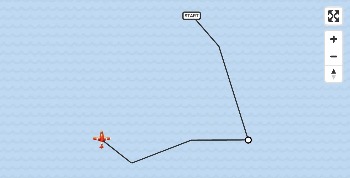
On Monday, 23 March 2026 at 13:21, a Coastguard Drone departed from North Sea to North Sea. It was the Coastguard Drone with registration number G-UASA. The flight lasted 2 minutes. During that period, the aircraft travelled 2 miles at an average speed of 56 miles per hour at a maximum altitude of 300 feet.
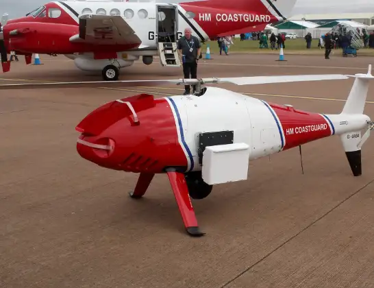
Helicopter: G-UASA
The drone G-UASA is used by the British Coastguard. The drone is deployed in search and rescue operations at sea, rescue operations involving ships or drilling platforms, patrols to prevent smuggling or piracy, environmental monitoring and disaster relief support.
Photo: Mike Burdett, CROMER, UK
3 miles
300 feet
56 mph
3 minutes
13:21
13:23

Route
North Sea, 13:23
Noordzee13:22
North Sea, 13:21
Live flights
Today
Police Helicopter to East Ardsley, Stoney Lane11 Jun 23:34
Police Helicopter to Manchester Barton Aerodrome11 Jun 23:31
Police Helicopter to Sewardstonebury, Bury Road11 Jun 23:00
Police Helicopter to Broughton, Manor Farm Court11 Jun 22:51
Police Helicopter to North Weald Airfield11 Jun 22:37
Police Helicopter to Peniel, B450111 Jun 22:29
Police Helicopter to Birmingham Airport11 Jun 22:25
Police Helicopter to Sulby, Sulby Road11 Jun 21:29
Air Ambulance Helicopter to RAF Northolt11 Jun 21:25
Police Helicopter to North Weald Airfield11 Jun 21:18
Helicopter flights on your website?
You can easily display helicopter flights on your own website. Use the embed code.
