Air Ambulance Helicopter to Egglescliffe, Black Path
Monday, 23 March 2026 | 12:01 | From Middlesbrough
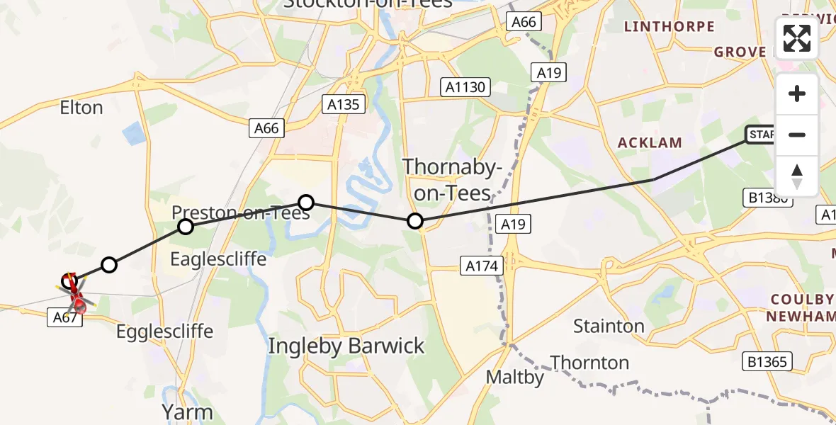
On Monday, 23 March 2026 at 12:01, a Air Ambulance Helicopter departed from Middlesbrough to Egglescliffe. It was the Air Ambulance Helicopter with registration number G-NHAE. The flight lasted 15 minutes. During that period, the aircraft travelled 7 miles at an average speed of 28 miles per hour at a maximum altitude of 950 feet.
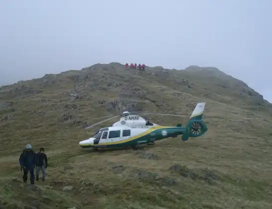
Helicopter: G-NHAE
The helicopter G-NHAE is used as a air ambulance helicopter. The main purpose of this aircraft is to transport a Mobile Medical Team to an incident as quickly as possible, enabling the trauma doctor to provide immediate first aid on site. The aircraft is flying this flight as Air Ambulance Helicopter.
Photo: Michael Earnshaw
7 miles
950 feet
28 mph
15 minutes
12:01
12:16

Route
Egglescliffe, Tees Valley12:06
Egglescliffe, Tees Valley12:06
Eaglescliffe, Tees Valley12:05
Preston-on-Tees, Tees Valley12:05
Stockton-on-Tees, Tees Valley12:04
RAF Thornaby, Stockton-on-Tees, North Yorkshire12:03
Black Path, Tees Valley12:01
Today
Flights Egglescliffe
Air Ambulance Helicopter to Egglescliffe, A6713 Jul 15:39
Air Ambulance Helicopter to Egglescliffe, A6713 Jul 13:57
Air Ambulance Helicopter to Egglescliffe10 Jul 15:36
Flights Middlesbrough
Air Ambulance Helicopter to Ousby27 Jun 14:53
Police Helicopter to Middlesbrough, Marton Road21 Jun 10:53
Air Ambulance Helicopter to Egglescliffe27 Apr 11:40
Helicopter flights on your website?
You can easily display helicopter flights on your own website. Use the embed code.
