Coastguard Drone to North Sea
Monday, 23 March 2026 | 10:58 | From English Channel
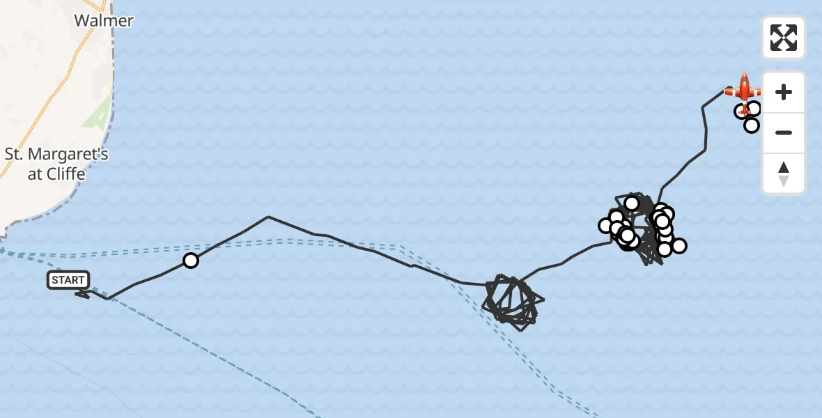
On Monday, 23 March 2026 at 10:58, a Coastguard Drone departed from English Channel to North Sea. It was the Coastguard Drone with registration number G-UASA. The flight lasted 116 minutes. During that period, the aircraft travelled 131 miles at an average speed of 68 miles per hour at a maximum altitude of 1800 feet.
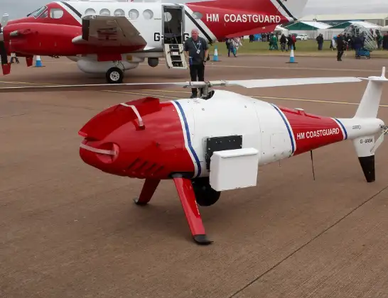
Helicopter: G-UASA
The drone G-UASA is used by the British Coastguard. The drone is deployed in search and rescue operations at sea, rescue operations involving ships or drilling platforms, patrols to prevent smuggling or piracy, environmental monitoring and disaster relief support.
Photo: Mike Burdett, CROMER, UK
131 miles
1800 feet
68 mph
116 minutes
10:58
12:54

Route
North Sea, 12:54
Noordzee12:51
North Sea12:51
Noordzee12:51
North Sea12:46
Noordzee12:45
North Sea12:43
Noordzee12:41
North Sea12:40
Noordzee12:38
North Sea12:36
Noordzee12:34
North Sea12:33
Noordzee12:32
North Sea12:30
Noordzee12:28
North Sea12:26
Noordzee12:25
North Sea12:23
Noordzee12:22
North Sea12:20
Noordzee12:19
North Sea12:16
Noordzee12:15
North Sea12:13
Noordzee12:12
North Sea12:10
Noordzee12:08
North Sea12:06
Noordzee12:05
North Sea12:04
Noordzee12:01
North Sea12:00
Noordzee11:58
North Sea11:56
Noordzee11:55
North Sea11:53
Noordzee11:52
North Sea11:50
Noordzee11:48
North Sea11:47
Noordzee11:45
North Sea11:03
English Channel, 10:58
Live flights
Today
Police Helicopter to Manchester Barton Aerodrome11 Jun 23:39
Police Helicopter to Birmingham Airport11 Jun 23:30
Helicopter flights on your website?
You can easily display helicopter flights on your own website. Use the embed code.
