Air Ambulance Helicopter to Cardiff Heliport
Sunday, 22 March 2026 | 18:32 | From Abergavenny
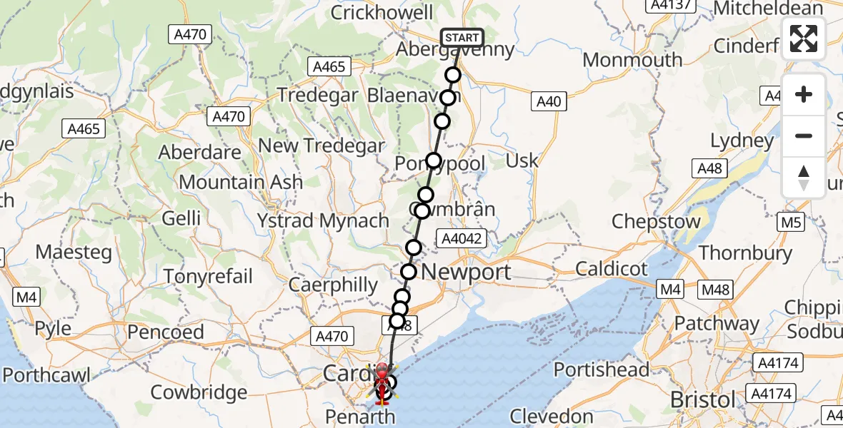
On Sunday, 22 March 2026 at 18:32, a Air Ambulance Helicopter departed from Abergavenny to Cardiff Heliport. It was the Air Ambulance Helicopter with registration number G-WROL. The flight lasted 13 minutes. During that period, the aircraft travelled 27 miles at an average speed of 128 miles per hour at a maximum altitude of 2425 feet.
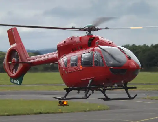
Helicopter: G-WROL
The helicopter G-WROL is used as a air ambulance helicopter. The main purpose of this aircraft is to transport a Mobile Medical Team to an incident as quickly as possible, enabling the trauma doctor to provide immediate first aid on site. The aircraft is flying this flight as Air Ambulance Helicopter.
Photo: James from Cheltenham, Gloucestershire
28 miles
2425 feet
128 mph
13 minutes
18:32
18:45

Route
Cardiff Heliport, Cardiff18:45
Cardiff Heliport, Cardiff18:44
Cardiff, Cardiff18:43
Tremorfa, Tremorfa18:43
Cardiff, Cardiff18:40
Newport, Newport18:40
Rudry, Rudry18:40
Rhiwderin, Rhiwderin18:39
Risca, Risca18:38
Henllys, Henllys18:37
Cwmbrân, Cwmbrân18:37
Pontypool, Pontypool18:36
Abersychan, Abersychan18:35
Goetre Fawr, Goetre Fawr18:34
Llanellen, Llanellen18:34
Ross Road, Abergavenny18:32
Live flights
Today
Flights Abergavenny
Air Ambulance Helicopter to Cardiff Heliport8 Jul 19:07
Air Ambulance Helicopter to Cardiff Heliport29 Jun 19:54
Air Ambulance Helicopter to Cardiff Heliport30 May 11:55
Air Ambulance Helicopter to Cardiff Heliport15 May 07:16
Police Helicopter to Flemingston, Mallory Close29 Mar 08:48
Helicopter flights on your website?
You can easily display helicopter flights on your own website. Use the embed code.
