Air Ambulance Helicopter to Little Irchester, Kingsway
Sunday, 22 March 2026 | 17:19 | From Coventry Airport
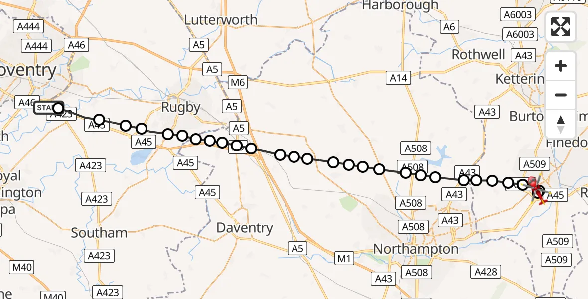
On Sunday, 22 March 2026 at 17:19, a Air Ambulance Helicopter departed from Coventry Airport to Little Irchester. It was the Air Ambulance Helicopter with registration number G-WNAS. The flight lasted 13 minutes. During that period, the aircraft travelled 33 miles at an average speed of 152 miles per hour at a maximum altitude of 1425 feet.
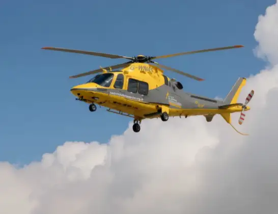
Helicopter: G-WNAS
The helicopter G-WNAS is used as an ambulance helicopter. The helicopter is equipped with a stretcher for transporting patients. The helicopter is often used to transport to hospitals.
Photo: Tony Melony
34 miles
1425 feet
152 mph
14 minutes
17:19
17:32

Route
Kingsway, Wellingborough17:32
Wellingborough, Wellingborough17:32
Little Irchester, Wellingborough17:32
Wellingborough, Wellingborough17:31
Wilby, Wilby17:31
Mears Ashby, Mears Ashby17:30
Sywell, Sywell17:30
Overstone, Overstone17:30
Moulton, Moulton17:29
Pitsford, Pitsford17:29
Brixworth, Brixworth17:28
Spratton, Spratton17:28
Teeton, Teeton17:27
Holdenby, Holdenby17:27
Ravensthorpe, Ravensthorpe17:27
Long Buckby, Long Buckby17:26
Watford, Watford17:26
West Haddon, West Haddon17:25
Crick, Crick17:25
Kilsby, Kilsby17:24
Barby, Barby17:24
Crick, Crick17:24
Barby, Barby17:23
Rugby, Rugby17:23
Bilton, Rugby17:23
Dunchurch, Rugby17:22
RAF Church Lawford, Coventry, Warwickshire17:21
Wolston CP, Rugby17:21
Ryton-on-Dunsmore, Rugby17:20
Woodhams Road, Warwick17:19
Today
Helicopter flights on your website?
You can easily display helicopter flights on your own website. Use the embed code.
