Air Ambulance Helicopter to Coventry Airport
Sunday, 22 March 2026 | 16:26 | From Northampton
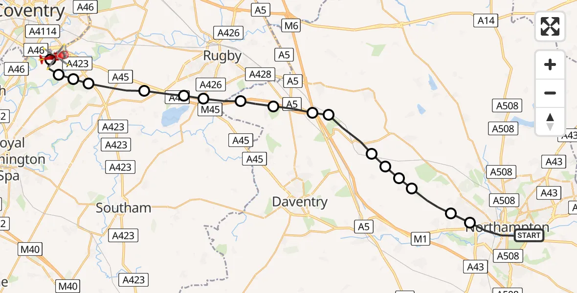
On Sunday, 22 March 2026 at 16:26, a Air Ambulance Helicopter departed from Northampton to Coventry Airport. It was the Air Ambulance Helicopter with registration number G-WNAS. The flight lasted 11 minutes. During that period, the aircraft travelled 29 miles at an average speed of 156 miles per hour at a maximum altitude of 1250 feet.
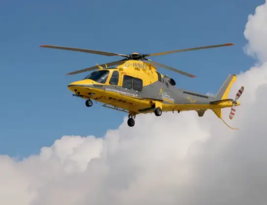
Helicopter: G-WNAS
The helicopter G-WNAS is used as an ambulance helicopter. The helicopter is equipped with a stretcher for transporting patients. The helicopter is often used to transport to hospitals.
Photo: Tony Melony
30 miles
1250 feet
156 mph
12 minutes
16:26
16:37

Route
Coventry Airport, Coventry, West Midlands16:37
Coventry Airport, Coventry, West Midlands16:37
Baginton, Warwick16:36
Bubbenhall, Warwick16:36
Rugby, Rugby16:36
Stretton on Dunsmore CP, Rugby16:34
Thurlaston CP, Rugby16:34
Dunchurch, Rugby16:33
Onley, Onley16:33
Barby, Barby16:32
Crick, Crick16:31
Watford, Watford16:31
Long Buckby, Long Buckby16:30
Whilton, Whilton16:29
Great Brington, Great Brington16:29
Upper Harlestone, Upper Harlestone16:29
Harpole, Harpole16:28
Duston, Duston16:27
Rushmere Road, Northampton16:26
Live flights
Today
Flights Northampton
Air Ambulance Helicopter to Coventry Airport7 Jul 19:58
Air Ambulance Helicopter to Sywell Aerodrome3 Jul 07:57
Helicopter flights on your website?
You can easily display helicopter flights on your own website. Use the embed code.
