Air Ambulance Helicopter to Derriford Hospital
Sunday, 22 March 2026 | 14:30 | From East Portlemouth
On Sunday, 22 March 2026 at 14:30, a Air Ambulance Helicopter departed from East Portlemouth to Derriford Hospital. It was the Air Ambulance Helicopter with registration number G-CRWL. The flight lasted 11 minutes. During that period, the aircraft travelled 20 miles at an average speed of 109 miles per hour at a maximum altitude of 875 feet.
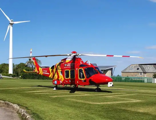
Helicopter: G-CRWL
The helicopter G-CRWL is used as a air ambulance helicopter. The main purpose of this aircraft is to transport a Mobile Medical Team to an incident as quickly as possible, enabling the trauma doctor to provide immediate first aid on site. The aircraft is flying this flight as Air Ambulance Helicopter.
Photo: Jowaninpensans
21 miles
875 feet
109 mph
12 minutes
14:30
14:41

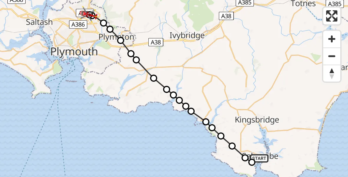
Route
Derriford Hospital, Plymouth14:41
Derriford Hospital, Plymouth14:40
Plymouth, Plymouth14:39
Plympton, Plymouth14:39
Colebrook Village, Plymouth14:38
Plympton, Plymouth14:38
Sherford, South Hams14:37
Brixton, South Hams14:37
Yealmpton, South Hams14:36
Holbeton, South Hams14:35
Mothecombe, South Hams14:35
Kingston, South Hams14:34
South Hams, Devon and Torbay14:34
Kingston, South Hams14:34
Bigbury-on-Sea, South Hams14:33
Thurlestone, South Hams14:32
South Hams, Devon and Torbay14:32
Galmpton, South Hams14:31
Malborough, South Hams14:31
Malborough, Salcombe14:30
Camperdown Road, Salcombe14:30
Live flights
Today
Helicopter flights on your website?
You can easily display helicopter flights on your own website. Use the embed code.
