Police Helicopter to Crowmarsh Gifford, Cox's Lane
Saturday, 21 March 2026 | 21:15 | From Crowmarsh Gifford
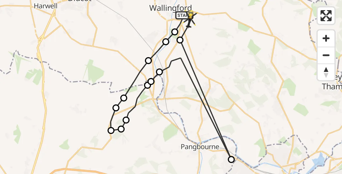
On Saturday, 21 March 2026 at 21:15, a Police Helicopter departed from Crowmarsh Gifford to Crowmarsh Gifford. It was the Police Helicopter with registration number G-POLF. The flight lasted 9 minutes. During that period, the aircraft travelled 29 miles at an average speed of 193 miles per hour at a maximum altitude of 1500 feet.
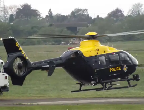
Helicopter: G-POLF
The helicopter G-POLF is used by the British police. The helicopter is deployed in pursuits, missing persons cases and other incidents where a helicopter provides added value.
Photo: James
30 miles
1500 feet
193 mph
10 minutes
21:15
21:24

Route
Cox's Lane, South Oxfordshire21:24
North Stoke, South Oxfordshire21:23
Tilehurst, Tilehurst21:23
South Stoke, South Oxfordshire21:22
Streatley, Streatley21:21
Moulsford, Moulsford21:21
Streatley, Streatley21:19
Ashampstead, Ashampstead21:19
Hampstead Norreys, Hampstead Norreys21:19
Aldworth, Aldworth21:18
Reading, Reading21:18
Moulsford, South Oxfordshire21:17
Cholsey, South Oxfordshire21:16
North Stoke, South Oxfordshire21:16
Port Way, South Oxfordshire21:15
Live flights
Today
Helicopter flights on your website?
You can easily display helicopter flights on your own website. Use the embed code.
