Air Ambulance Aircraft to North Sea
Friday, 20 March 2026 | 21:10 | From Aberdeen International Airport
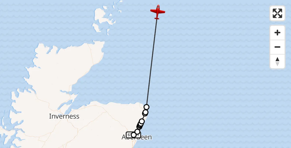
On Friday, 20 March 2026 at 21:10, a Air Ambulance Aircraft departed from Aberdeen International Airport to North Sea. It was the Air Ambulance Aircraft with registration number G-SASC. The flight lasted 28 minutes. During that period, the aircraft travelled 139 miles at an average speed of 301 miles per hour at a maximum altitude of 19025 feet.
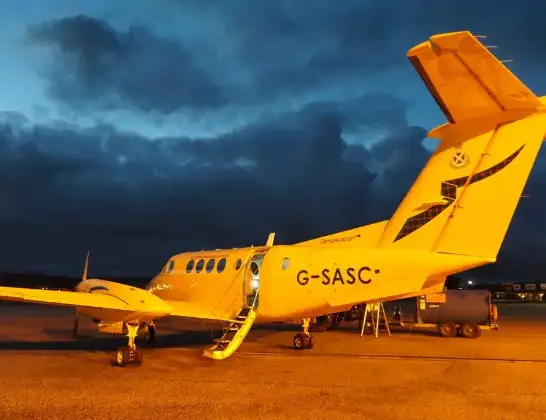
Helicopter: G-SASC
The aircraft G-SASC is used as an air ambulance aircraft. The main purpose of this aircraft is to transport a Mobile Medical Team to an incident as quickly as possible, enabling the trauma doctor to provide immediate first aid on site. The aircraft is flying this flight as Air Ambulance Aircraft.
Photo: Mike Pennington
139 miles
19025 feet
301 mph
28 minutes
21:10
21:37

Route
North Sea, 21:37
North Sea21:19
St Fergus, St Fergus21:18
Inverugie, Inverugie21:18
Hatton, Hatton21:15
Cotehill, Cotehill21:15
Cruden Bay, Cruden Bay21:14
Ythan Estuary21:14
Newburgh, Newburgh21:14
Balmedie, Balmedie21:12
Aberdeen City, Aberdeen City21:10
Aberdeen International Airport, Aberdeen21:10
Today
Helicopter flights on your website?
You can easily display helicopter flights on your own website. Use the embed code.
