Coastguard Helicopter to Aberdeen International Airport
Friday, 20 March 2026 | 19:15 | From North Sea
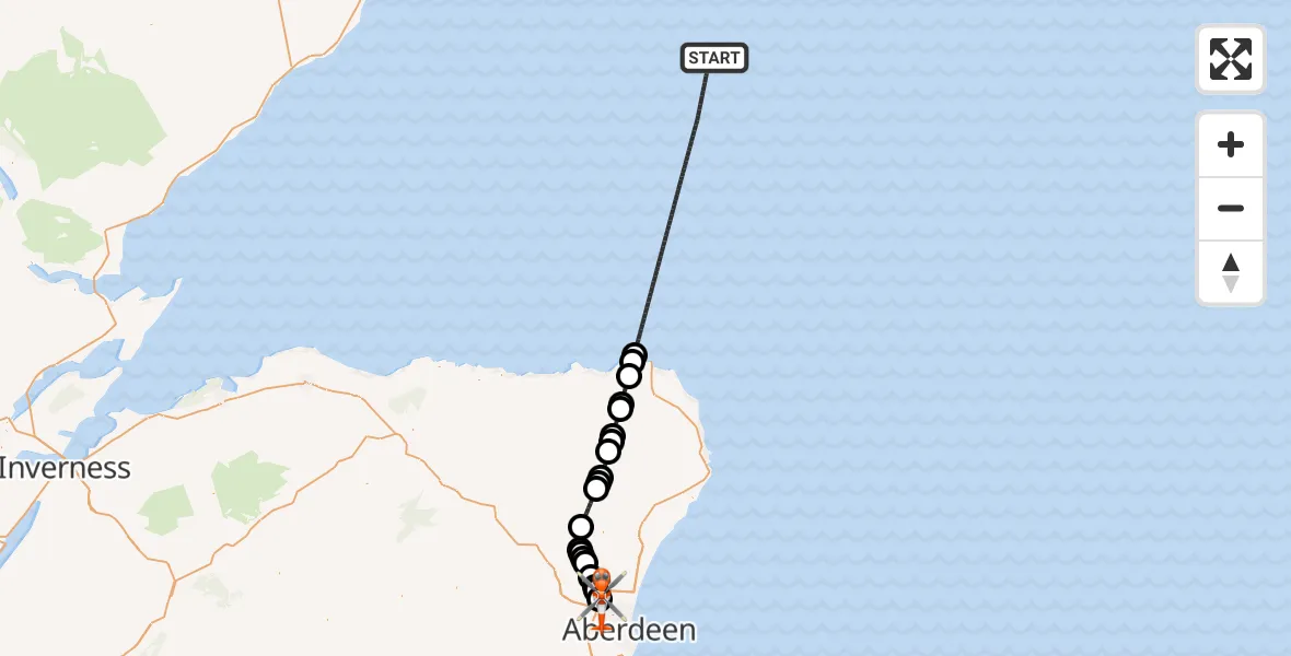
On Friday, 20 March 2026 at 19:15, a Coastguard Helicopter departed from North Sea to Aberdeen International Airport. It was the Coastguard Helicopter with registration number G-MCGX. The flight lasted 38 minutes. During that period, the aircraft travelled 80 miles at an average speed of 125 miles per hour at a maximum altitude of 2925 feet.
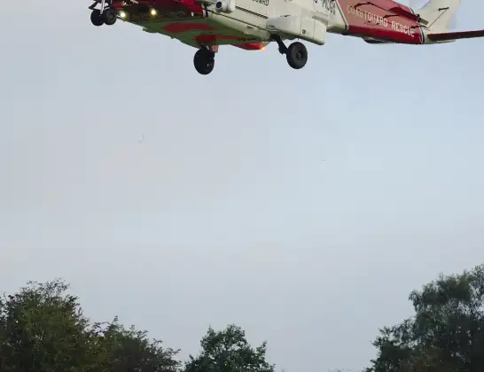
Helicopter: G-MCGX
The helicopter G-MCGX is used by the British Coastguard. The helicopter is deployed in search and rescue operations at sea, rescue operations involving ships or drilling platforms, patrols to prevent smuggling or piracy, environmental monitoring and disaster relief support.
Photo: Nick (UK)
80 miles
2925 feet
125 mph
39 minutes
19:15
19:53

Route
Aberdeen International Airport, Aberdeen19:53
Aberdeen International Airport, Aberdeen19:52
Aberdeen International Airport, Aberdeen19:51
Aberdeen City, Aberdeen City19:50
Cothal, Cothal19:50
Newmachar, Newmachar19:49
Keithhall, Keithhall19:48
Old Kendal, Old Kendal19:48
Keithhall, Keithhall19:48
Kirkton of Bourtie, Kirkton of Bourtie19:47
Oldmeldrum, Oldmeldrum19:46
Methlick, Methlick19:43
Monteach Road, Monteach Road19:43
Cairnorrie, Cairnorrie19:43
New Deer, New Deer19:41
Maud, Maud19:41
New Deer, New Deer19:40
Strichen, Strichen19:39
Boyndlie, Boyndlie19:38
Memsie, Memsie19:37
Sandhaven, Sandhaven19:36
Pittulie, Pittulie19:35
North Sea, 19:15
Live flights
Today
Helicopter flights on your website?
You can easily display helicopter flights on your own website. Use the embed code.
