Air Ambulance Helicopter to North Weald Airfield
Friday, 20 March 2026 | 18:34 | From London Borough of Havering
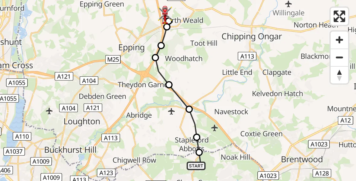
On Friday, 20 March 2026 at 18:34, a Air Ambulance Helicopter departed from London Borough of Havering to North Weald Airfield. It was the Air Ambulance Helicopter with registration number G-HHEM. The flight lasted 10 minutes. During that period, the aircraft travelled 8 miles at an average speed of 48 miles per hour at a maximum altitude of 775 feet.
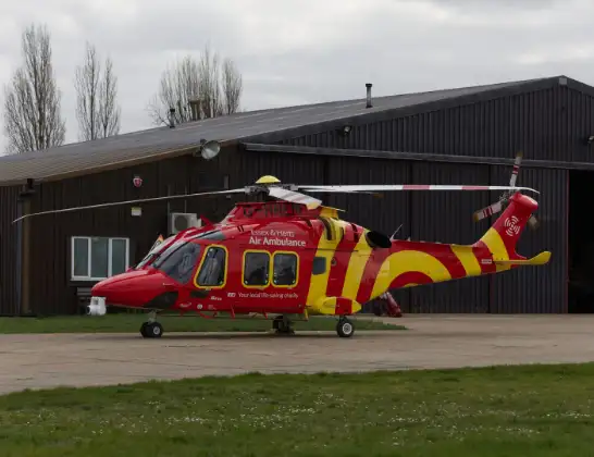
Helicopter: G-HHEM
The helicopter G-HHEM is used as a air ambulance helicopter. The main purpose of this aircraft is to transport a Mobile Medical Team to an incident as quickly as possible, enabling the trauma doctor to provide immediate first aid on site. The aircraft is flying this flight as Air Ambulance Helicopter.
Photo: Ronnie Macdonald
9 miles
775 feet
48 mph
11 minutes
18:34
18:44

Route
North Weald Airfield, Epping, Essex18:44
North Weald Airfield, Epping, Essex18:43
North Weald Airfield, Epping, Essex18:42
North Weald Bassett, Epping Forest18:41
Coopersale, Epping Forest18:41
Coopersale Street, Epping Forest18:40
Theydon Garnon, Epping Forest18:40
Epping Forest, Epping Forest18:39
Stapleford Abbotts, Epping Forest18:38
London Borough of Havering, Greater London18:38
North Road, Greater London18:37
London Borough of Havering, Greater London18:34
Live flights
Today
Helicopter flights on your website?
You can easily display helicopter flights on your own website. Use the embed code.
