Police Helicopter to Redhill Aerodrome
Friday, 20 March 2026 | 16:39 | From Little Horsted
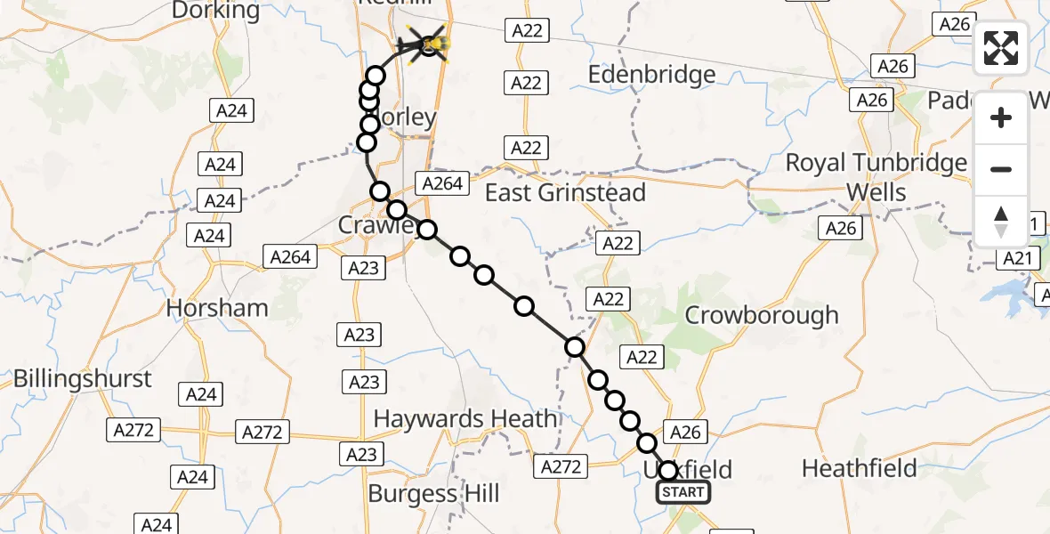
On Friday, 20 March 2026 at 16:39, a Police Helicopter departed from Little Horsted to Redhill Aerodrome. It was the Police Helicopter with registration number G-POLH. The flight lasted 11 minutes. During that period, the aircraft travelled 24 miles at an average speed of 134 miles per hour at a maximum altitude of 1100 feet.
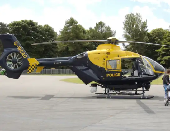
Helicopter: G-POLH
The helicopter G-POLH is used by the British police. The helicopter is deployed in pursuits, missing persons cases and other incidents where a helicopter provides added value.
Photo: Arpingstone
25 miles
1100 feet
134 mph
11 minutes
16:39
16:50

Route
Redhill Aerodrome, Redhill, Surrey16:50
Tandridge, Tandridge16:50
Salfords, Reigate and Banstead16:49
Reigate and Banstead, Reigate and Banstead16:48
Horley, Reigate and Banstead16:48
Hookwood, Mole Valley16:47
London Gatwick Airport, London16:47
Manor Royal, Crawley16:46
Three Bridges, Crawley16:46
Maidenbower, Crawley16:45
Turners Hill, Mid Sussex16:45
Ardingly, Mid Sussex16:44
West Hoathly, Mid Sussex16:43
Horsted Keynes, Mid Sussex16:42
Chelwood Common, Wealden16:41
Nutley, Wealden16:41
Fletching, Wealden16:41
Piltdown, Wealden16:40
Uckfield, Wealden16:40
Pasture Place, Wealden16:39
Today
Helicopter flights on your website?
You can easily display helicopter flights on your own website. Use the embed code.
