Air Ambulance Helicopter to Builth Wells, Trehelig
Friday, 20 March 2026 | 12:13 | From Welshpool Airport
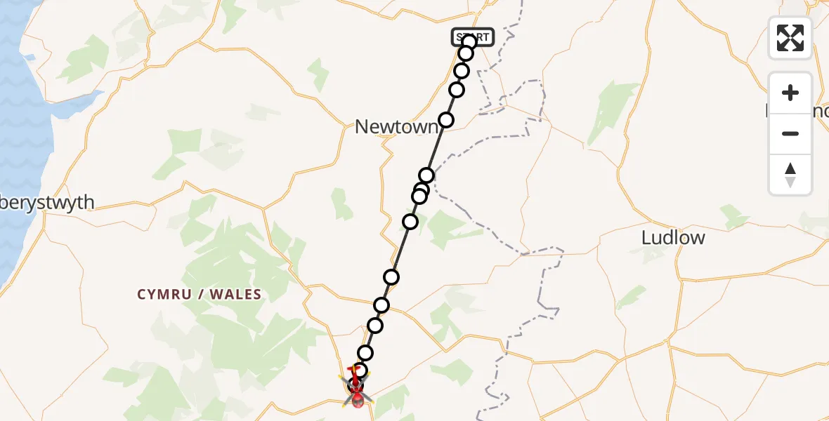
On Friday, 20 March 2026 at 12:13, a Air Ambulance Helicopter departed from Welshpool Airport to Builth Wells. It was the Air Ambulance Helicopter with registration number G-WENU. The flight lasted 28 minutes. During that period, the aircraft travelled 34 miles at an average speed of 73 miles per hour at a maximum altitude of 2225 feet.
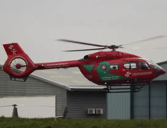
Helicopter: G-WENU
The helicopter G-WENU is used as a air ambulance helicopter. The main purpose of this aircraft is to transport a Mobile Medical Team to an incident as quickly as possible, enabling the trauma doctor to provide immediate first aid on site. The aircraft is flying this flight as Air Ambulance Helicopter.
Photo: James from Cheltenham, Gloucestershire
34 miles
2225 feet
73 mph
28 minutes
12:13
12:41

Route
Builth Wells, Builth Wells12:31
Builth Wells, Builth Wells12:31
Disserth and Trecoed, Disserth and Trecoed12:30
Crossway, Crossway12:30
Llandrindod, Llandrindod12:29
Crossgates, Crossgates12:28
Llanddewi Ystradenni, Llanddewi Ystradenni12:27
Llanbister, Llanbister12:24
Beguildy, Beguildy12:23
Dolfor, Dolfor12:23
Beguildy, Beguildy12:22
Kerry, Kerry12:20
Llandyssil, Llandyssil12:19
Caerhowel, Caerhowel12:18
Refail, Refail12:17
Trehelig, Welshpool12:16
Welshpool Airport, Welshpool, Powys12:13
Live flights
Today
Helicopter flights on your website?
You can easily display helicopter flights on your own website. Use the embed code.
