Air Ambulance Helicopter to Redhill Aerodrome
Thursday, 19 March 2026 | 22:40 | From Kings College London Hospital
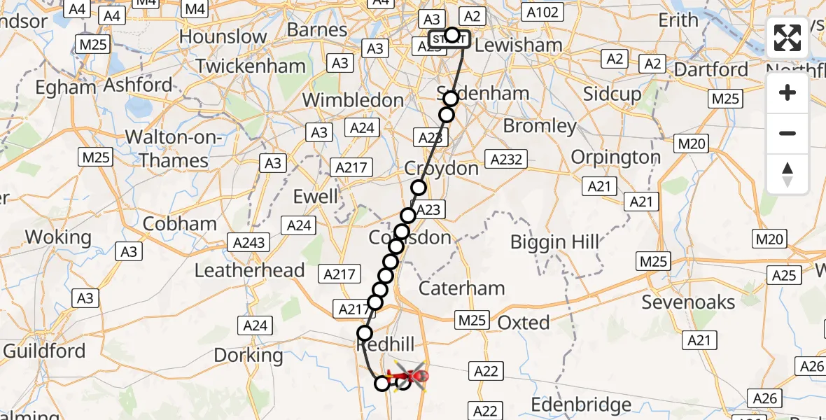
On Thursday, 19 March 2026 at 22:40, a Air Ambulance Helicopter departed from Kings College London Hospital to Redhill Aerodrome. It was the Air Ambulance Helicopter with registration number G-KSSC. The flight lasted 18 minutes. During that period, the aircraft travelled 21 miles at an average speed of 73 miles per hour at a maximum altitude of 1000 feet.
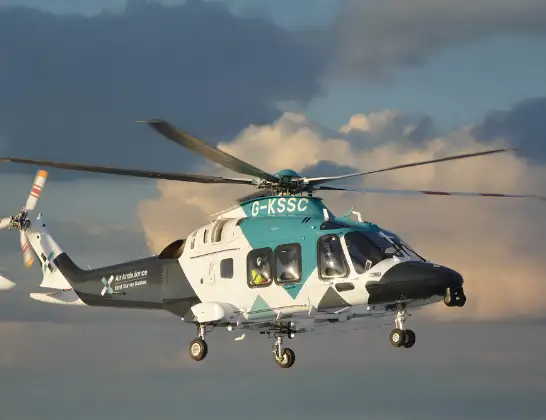
Helicopter: G-KSSC
The helicopter G-KSSC is used as a air ambulance helicopter. The main purpose of this aircraft is to transport a Mobile Medical Team to an incident as quickly as possible, enabling the trauma doctor to provide immediate first aid on site. The aircraft is flying this flight as Air Ambulance Helicopter.
Photo: Shona aakss
22 miles
1000 feet
73 mph
18 minutes
22:40
22:57

Route
Redhill Aerodrome, Redhill, Surrey22:57
Redhill Aerodrome, Redhill, Surrey22:55
Salfords, Reigate and Banstead22:55
Reigate, Reigate and Banstead22:53
Gatton, Reigate and Banstead22:52
Hooley, Reigate and Banstead22:52
Chipstead Private Airstrip, Coulsdon, Greater London22:52
Chipstead, Reigate and Banstead22:51
London Borough of Croydon, Greater London22:51
Coulsdon, Greater London22:51
London Borough of Croydon, Greater London22:51
London Borough of Sutton, Greater London22:50
London Borough of Croydon, Greater London22:48
London Borough of Lambeth, Greater London22:48
Ondine Road, Greater London22:47
London Borough of Southwark, Greater London22:46
Kings College London Hospital, London22:40
Today
Helicopter flights on your website?
You can easily display helicopter flights on your own website. Use the embed code.
