Coastguard Helicopter to Manston Airport
Thursday, 19 March 2026 | 18:09 | From Manston Airport
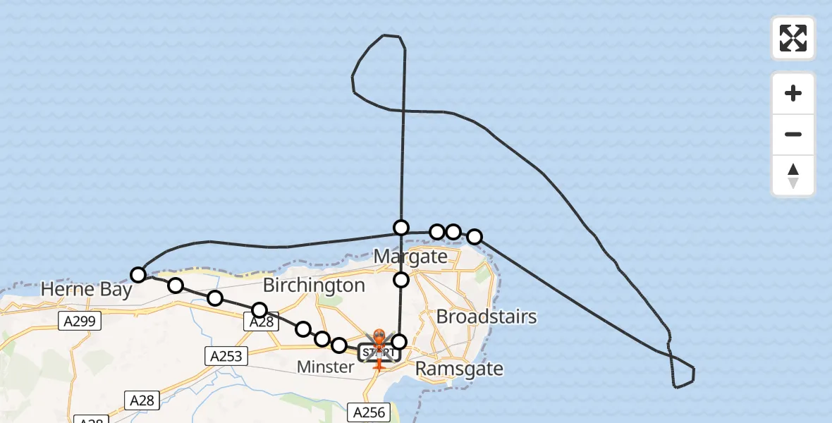
On Thursday, 19 March 2026 at 18:09, a Coastguard Helicopter departed from Manston Airport to Manston Airport. It was the Coastguard Helicopter with registration number G-RESF. The flight lasted 98 minutes. During that period, the aircraft travelled 60 miles at an average speed of 37 miles per hour at a maximum altitude of 1175 feet.

Helicopter: G-RESF
The helicopter G-RESF is used by the British Coastguard. The helicopter is deployed in search and rescue operations at sea, rescue operations involving ships or drilling platforms, patrols to prevent smuggling or piracy, environmental monitoring and disaster relief support.
Photo: Tony Melony
60 miles
1175 feet
37 mph
98 minutes
18:09
19:47

Route
Manston Airport, Ramsgate, Kent19:47
Manston Airport, Ramsgate, Kent19:46
Minster, Thanet19:45
Monkton, Thanet19:45
St Nicholas-at-Wade, Birchington19:44
St Nicholas-at-Wade, Thanet19:44
Northern Sea Wall, Canterbury19:43
Oyster Bay Trail, Canterbury19:42
Oyster Bay Trail, Canterbury19:40
Oyster Bay Trail, Canterbury19:14
Oyster Bay Trail, Canterbury19:11
Hillborough, Canterbury19:05
North Sea18:59
Northdown, Northdown18:59
Margate, Thanet18:59
North Sea18:15
Margate, Thanet18:14
Highlands Glade, Thanet18:12
Manston Airport, Ramsgate, Kent18:09
Today
Police Helicopter to Falkirk02:12:08
Helicopter flights on your website?
You can easily display helicopter flights on your own website. Use the embed code.
