Air Ambulance Helicopter to Queens Hospital Romford
Thursday, 19 March 2026 | 17:38 | From London Borough of Ealing
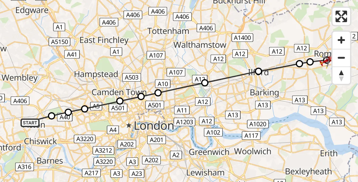
On Thursday, 19 March 2026 at 17:38, a Air Ambulance Helicopter departed from London Borough of Ealing to Queens Hospital Romford. It was the Air Ambulance Helicopter with registration number G-LAAB. The flight lasted 13 minutes. During that period, the aircraft travelled 20 miles at an average speed of 91 miles per hour at a maximum altitude of 900 feet.
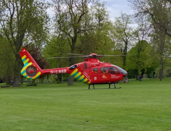
Helicopter: G-LAAB
The helicopter G-LAAB is used as a air ambulance helicopter. The main purpose of this aircraft is to transport a Mobile Medical Team to an incident as quickly as possible, enabling the trauma doctor to provide immediate first aid on site. The aircraft is flying this flight as Air Ambulance Helicopter.
Photo: Celsoazevedo
21 miles
900 feet
91 mph
14 minutes
17:38
17:52

Route
Queens Hospital Romford, Romford17:52
Queens Hospital Romford, Romford17:52
Queens Hospital Romford, Romford17:51
London Borough of Havering, Greater London17:49
London Borough of Barking and Dagenham, Greater London17:49
London Borough of Redbridge, Greater London17:48
London Borough of Newham, Greater London17:46
London Borough of Hackney, Greater London17:45
London Borough of Islington, Greater London17:44
London Borough of Camden, Greater London17:44
City of Westminster, City of Westminster17:43
Royal Borough of Kensington and Chelsea, Greater London17:42
London Borough of Hammersmith and Fulham, Greater London17:41
Baldwyn Gardens, Greater London17:41
London Borough of Ealing, Greater London17:38
Live flights
Today
Police Helicopter to Shrawardine14:30:16
Police Helicopter to Erbistock14:21:53
Helicopter flights on your website?
You can easily display helicopter flights on your own website. Use the embed code.
