Coastguard Helicopter to Mealabost
Thursday, 19 March 2026 | 4:16 | From North Atlantic Ocean
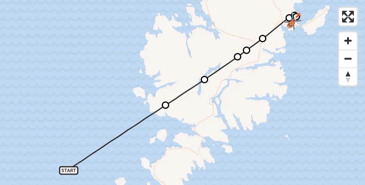
On Thursday, 19 March 2026 at 4:16, a Coastguard Helicopter departed from North Atlantic Ocean to Mealabost. It was the Coastguard Helicopter with registration number G-MCGG. The flight lasted 21 minutes. During that period, the aircraft travelled 54 miles at an average speed of 157 miles per hour at a maximum altitude of 3525 feet.
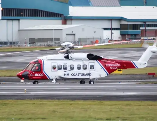
Helicopter: G-MCGG
The helicopter G-MCGG is used by the British Coastguard. The helicopter is deployed in search and rescue operations at sea, rescue operations involving ships or drilling platforms, patrols to prevent smuggling or piracy, environmental monitoring and disaster relief support.
Photo: Mark Harkin
54 miles
3525 feet
157 mph
21 minutes
04:16
04:37

Route
Mealabost, Mealabost04:37
Mealabost, Mealabost04:36
Àird Thunga, Àird Thunga04:35
Steinis, Steinis04:35
Steòrnabhagh, Steòrnabhagh04:32
An t-Achadh Mòr, An t-Achadh Mòr04:31
Baile Ailein, Baile Ailein04:30
Loch Langabhat04:28
Abhainn Suidhe, Abhainn Suidhe04:24
North Atlantic Ocean, 04:16
Live flights
Today
Flights Mealabost
Coastguard Helicopter to Stornoway Airport3 Jul 16:35
Coastguard Helicopter to Mealabost3 Jul 16:21
Coastguard Helicopter to Mealabost29 Jun 16:29
Coastguard Helicopter to Mealabost28 Jun 19:37
Coastguard Helicopter to Inner Seas27 Jun 15:45
Coastguard Helicopter to Inner Seas26 Jun 15:07
Coastguard Helicopter to Mealabost25 Jun 01:52
Coastguard Helicopter to Mealabost24 Jun 16:54
Coastguard Helicopter to Mealabost24 Jun 00:24
Coastguard Helicopter to Mealabost23 Jun 11:43
Helicopter flights on your website?
You can easily display helicopter flights on your own website. Use the embed code.
